File:1780 Bonne Map of Northern South America, Columbia, Venezuela, Brazil - Geographicus - SouthAmerNorth-bonne-1780.jpg
Size of this preview: 800 × 528 pixels. Other resolutions: 320 × 211 pixels | 640 × 422 pixels | 1,024 × 675 pixels | 1,280 × 844 pixels | 2,500 × 1,649 pixels.
Original file (2,500 × 1,649 pixels, file size: 1.39 MB, MIME type: image/jpeg)
Captions
Captions
Add a one-line explanation of what this file represents
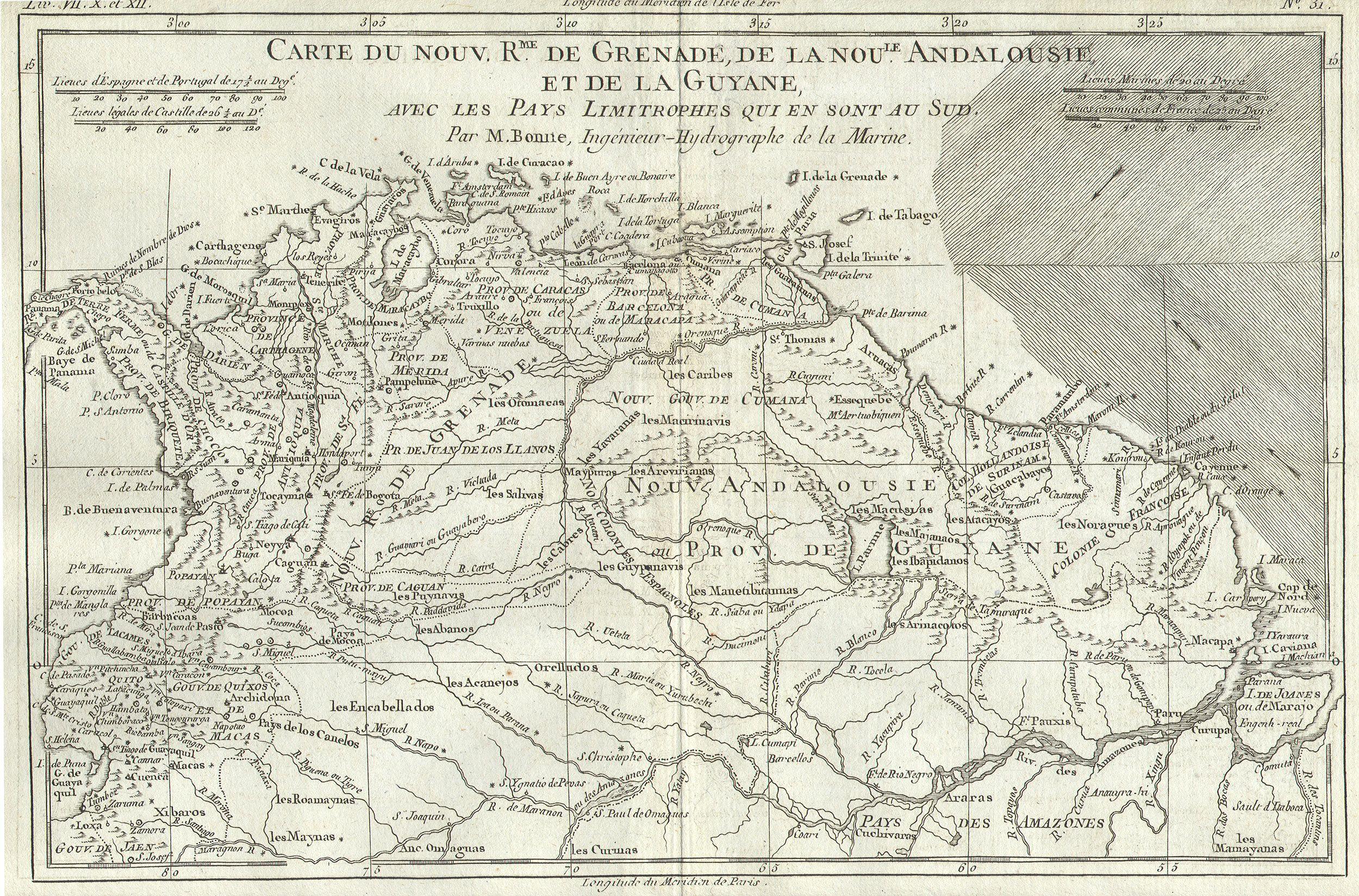
| Rigobert Bonne: Carte du Nouv. Rme. De Grenade, de la noule Andalousie, et de la Guyane, avec les Pays Limitrophes qui en sont au Sud.
( |
|||||||||||||||||||||||
|---|---|---|---|---|---|---|---|---|---|---|---|---|---|---|---|---|---|---|---|---|---|---|---|
| Artist |
|
||||||||||||||||||||||
| Title |
Carte du Nouv. Rme. De Grenade, de la noule Andalousie, et de la Guyane, avec les Pays Limitrophes qui en sont au Sud. |
||||||||||||||||||||||
| Description |
English: This remarkable map of the Northern South America (Columbia, Venezuela, Guyana, N. Brazil) by Rigobert Bonne was made in 1780. Bonne was the successor to Bellin as head Engineer of the French Hydrographe del la Marine Department. Much of the Amazon is shown and many South American Indian tribes are noted. Towns, churches, cities and mountains are depicted as miniature representations of themselves. This map is highly detailed and beautifully crafted. |
||||||||||||||||||||||
| Date | 1780 | ||||||||||||||||||||||
| Dimensions | height: 9 in (22.8 cm); width: 13 in (33 cm) | ||||||||||||||||||||||
| Accession number |
Geographicus link: SouthAmerNorth-bonne-1780 |
||||||||||||||||||||||
| Source/Photographer |
|
||||||||||||||||||||||
| Permission (Reusing this file) |
|
||||||||||||||||||||||
File history
Click on a date/time to view the file as it appeared at that time.
| Date/Time | Thumbnail | Dimensions | User | Comment | |
|---|---|---|---|---|---|
| current | 09:08, 16 March 2011 | | 2,500 × 1,649 (1.39 MB) | BotMultichill (talk | contribs) | {{subst:User:Multichill/Geographicus |link=http://www.geographicus.com/P/AntiqueMap/SouthAmerNorth-bonne-1780 |product_name=1780 Bonne Map of Northern South America: Columbia, Venezuela, Brazil |map_title=Carte du Nouv. Rme. De Grenade, de la noule Andalo |
You cannot overwrite this file.
File usage on Commons
The following page uses this file: