File:1799 Clement Cruttwell Map of Poland and Lithuania - Geographicus - Poland-cruttwell-1799.jpg
Size of this preview: 705 × 599 pixels. Other resolutions: 282 × 240 pixels | 565 × 480 pixels | 903 × 768 pixels | 1,205 × 1,024 pixels | 2,409 × 2,048 pixels | 4,931 × 4,192 pixels.
Original file (4,931 × 4,192 pixels, file size: 5.43 MB, MIME type: image/jpeg)
Captions
Captions
Add a one-line explanation of what this file represents
| Poland. | ||||||
|---|---|---|---|---|---|---|
| Artist | ||||||
| Title |
Poland. |
|||||
| Description |
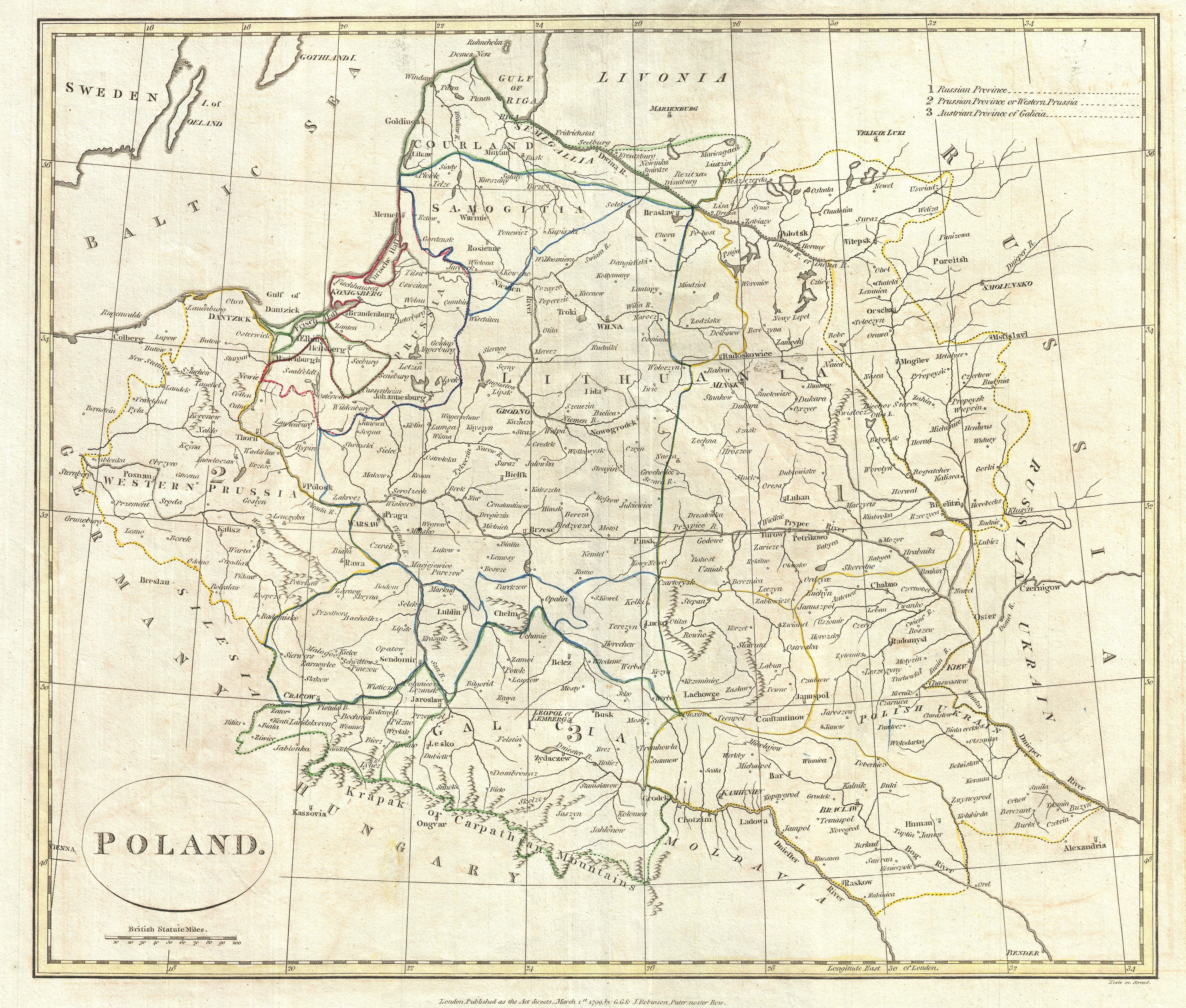
English: A fine 1799 map of Poland by the English mapmaker Clement Cruttwell. Shows the partitioning of the Polish-Lithuanian Commonwealth in 1765-1795 between Prussia, Austria, and Russia. The map covers the area from Poznan in the west to just west of Kiev in the east, and from as far south as Moldavan border. Makes note in the upper-right quadrant of the three partitioned areas: Russia, Prussia, and Austria. Russia claimed the bulk of what once comprised the Grand Duchy of Lithuania from Livonia south to Moldava. Prussia took hold of the area east of Warsaw, while Austria held claim to the area as far south as Galicia. Detailed borders also show the regions of Courland, Samoglita, and the Polish Ukraine. Outline color and fine copper plate engraving in the minimalist English style prevalent in the late 18th and early 19th centuries. Mountains and topographical other detail shown by profile. Also makes note of rivers and some offshore shoals. Drawn by Clement Cruttwell and published in the 1799 Atlas to Cruttwell's Gazetteer. |
|||||
| Date | 1799 (dated) | |||||
| Dimensions | height: 13.5 in (34.2 cm); width: 16 in (40.6 cm) | |||||
| Accession number |
Geographicus link: Poland-cruttwell-1799 |
|||||
| Source/Photographer |
Cruttwell, C., Atlas to Cruttwell's Gazetteer, 1799.
|
|||||
| Permission (Reusing this file) |
|
|||||
File history
Click on a date/time to view the file as it appeared at that time.
| Date/Time | Thumbnail | Dimensions | User | Comment | |
|---|---|---|---|---|---|
| current | 16:13, 24 March 2011 | | 4,931 × 4,192 (5.43 MB) | BotMultichillT (talk | contribs) | {{subst:User:Multichill/Geographicus |link=http://www.geographicus.com/P/AntiqueMap/Poland-cruttwell-1799 |product_name=1799 Clement Cruttwell Map of Poland and Lithuania |map_title=Poland. |description=A fine 1799 map of Poland by the English mapmaker Cl |
You cannot overwrite this file.
File usage on Commons
The following page uses this file:
File usage on other wikis
The following other wikis use this file:
- Usage on lt.wikibooks.org