File:1816 Weygand Nouvelle carte du Royaume des Pays-Bas.jpg
Size of this preview: 423 × 600 pixels. Other resolutions: 169 × 240 pixels | 556 × 788 pixels.
Original file (556 × 788 pixels, file size: 238 KB, MIME type: image/jpeg)
Captions
Captions
Add a one-line explanation of what this file represents
Summary edit
| Description |
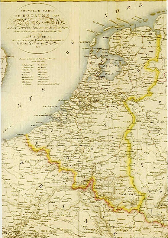
English: Francophone map of the United Kingdom of the Netherlands in 1816. |
| Date | |
| Source | |
| Author | F.J. Weygand |
| Other versions |
|

Licensing edit
|
This work is in the public domain in its country of origin and other countries and areas where the copyright term is the author's life plus 70 years or fewer. This work is in the public domain in the United States because it was published (or registered with the U.S. Copyright Office) before January 1, 1929. | |
| This file has been identified as being free of known restrictions under copyright law, including all related and neighboring rights. | |
File history
Click on a date/time to view the file as it appeared at that time.
| Date/Time | Thumbnail | Dimensions | User | Comment | |
|---|---|---|---|---|---|
| current | 10:17, 9 August 2020 | | 556 × 788 (238 KB) | Nederlandse Leeuw (talk | contribs) | Uploaded a work by F.J. Weygand from [https://nl.pinterest.com/pin/380343131022034181/ Pinterest] with UploadWizard |
You cannot overwrite this file.
File usage on Commons
There are no pages that use this file.