File:1821 Carey Map of India - Geographicus - India-carey-1821.jpg

Size of this preview: 726 × 600 pixels. Other resolutions: 291 × 240 pixels | 581 × 480 pixels | 930 × 768 pixels | 1,240 × 1,024 pixels | 2,480 × 2,048 pixels | 5,000 × 4,130 pixels.
Original file (5,000 × 4,130 pixels, file size: 6.29 MB, MIME type: image/jpeg)
Captions
Captions
Add a one-line explanation of what this file represents
| Geographical, Historical, and Statisitcal Map of India - Hindoostan; or India | ||||||
|---|---|---|---|---|---|---|
| Artist | ||||||
| Title |
Geographical, Historical, and Statisitcal Map of India - Hindoostan; or India |
|||||
| Description |
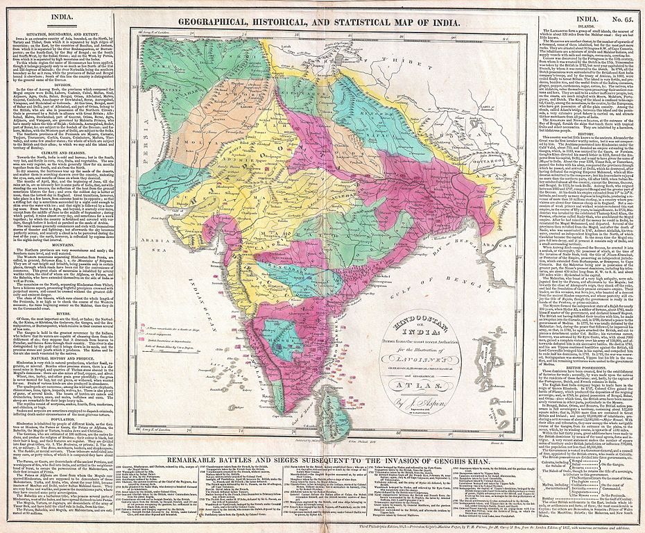
English: This is an attractive 1821 map of India issued by Matthew Carey. Covers the subcontinent from Tibet Kashmir south to Sri Lanka or Ceylon. Color coded according to territory with British possessions or dependencies in red. Shows the locations and dates of no less than twenty-five battles from 1300 to 1804. Surrounded by text discussing the geography, climate, history and peoples of India. Drawn by J. Aspin. Published by Matthew Carey & Son as plate no. 65 in the 1821 third Philadelphia edition of Lavoisne’s Genealogical, Historical, Chronological and Geographical Atlas. |
|||||
| Date | 1821 (dated) | |||||
| Dimensions | height: 17 in (43.1 cm); width: 21 in (53.3 cm) | |||||
| Accession number |
Geographicus link: India-carey-1821 |
|||||
| Source/Photographer |
Lavoisine, C. V., Lavoisne's Genealogical, Historical, Chronological And Geographical Atlas. (1821 Philadelphia Edition).
|
|||||
| Permission (Reusing this file) |
|
|||||
| Other versions | ||||||
.jpg)
.jpg)
File history
Click on a date/time to view the file as it appeared at that time.
| Date/Time | Thumbnail | Dimensions | User | Comment | |
|---|---|---|---|---|---|
| current | 18:32, 22 March 2011 | | 5,000 × 4,130 (6.29 MB) | BotMultichillT (talk | contribs) | {{subst:User:Multichill/Geographicus |link=http://www.geographicus.com/P/AntiqueMap/India-carey-1821 |product_name=1821 Carey Map of India |map_title=Geographical, Historical, and Statisitcal Map of India - Hindoostan; or India |description=This is an att |
You cannot overwrite this file.
File usage on Commons
The following 3 pages use this file: