File:1835 CourtHouse BostonBewickCo Boyton Boston map detail.png
No higher resolution available.
1835_CourtHouse_BostonBewickCo_Boyton_Boston_map_detail.png (779 × 517 pixels, file size: 711 KB, MIME type: image/png)
Captions
Captions
Add a one-line explanation of what this file represents
| Description |
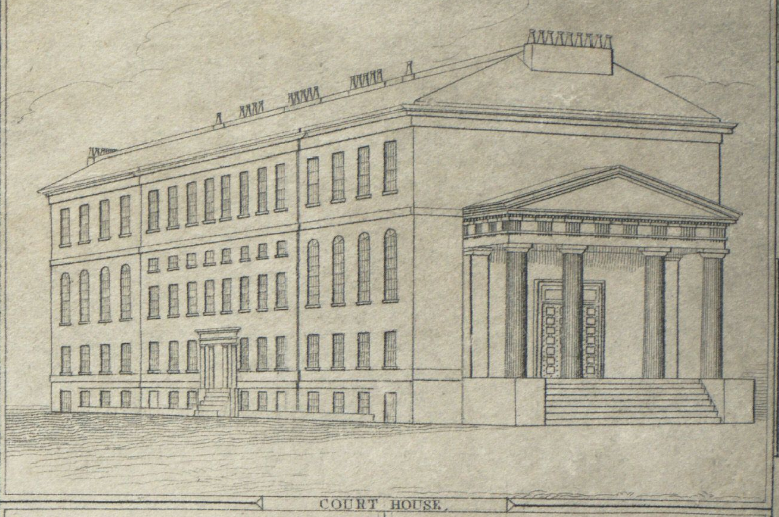
English: Court House, Boston. Detail of 1835 map of Boston by George W. Boynton, entitled "Plan of Boston with parts of the adjacent towns." Published by the Boston Bewick Company, 1835. |
| Date | |
| Source | Boston Public Library. http://maps.bpl.org/details_10946/?dl_pp=4&mtid=5 |
| Author | George W. Boynton |
This media file is in the public domain in the United States. This applies to U.S. works where the copyright has expired, often because its first publication occurred prior to January 1, 1929, and if not then due to lack of notice or renewal. See this page for further explanation.
|
 | |
 |
This image might not be in the public domain outside of the United States; this especially applies in the countries and areas that do not apply the rule of the shorter term for US works, such as Canada, Mainland China (not Hong Kong or Macao), Germany, Mexico, and Switzerland. The creator and year of publication are essential information and must be provided. See Wikipedia:Public domain and Wikipedia:Copyrights for more details.
|
File history
Click on a date/time to view the file as it appeared at that time.
| Date/Time | Thumbnail | Dimensions | User | Comment | |
|---|---|---|---|---|---|
| current | 15:04, 9 January 2010 | | 779 × 517 (711 KB) | M2545 (talk | contribs) | {{Information |Description={{en|1=Court House, Boston. Detail of 1835 map of Boston by George W. Boynton, entitled "Plan of Boston with parts of the adjacent towns." Published by the Boston Bewick Company, 1835.}} |Source=Boston Public Library. http://map |
You cannot overwrite this file.
File usage on Commons
There are no pages that use this file.