File:1837 Malte-Brun Map of Germany - Geographicus - GermanyNorth-mb-1837.jpg

Original file (2,355 × 1,746 pixels, file size: 819 KB, MIME type: image/jpeg)
Captions
Captions
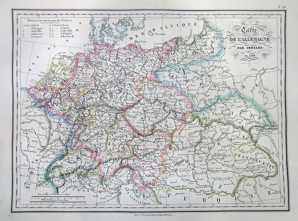
| Carte de L’Allemagne par Cercles en 1789. | ||||||
|---|---|---|---|---|---|---|
| Artist | ||||||
| Title |
Carte de L’Allemagne par Cercles en 1789. |
|||||
| Description |
English: This is a beautiful 1837 hand colored map of Northern Germany includes the regions of Hanover, Saxony, Hungary, Transylvania, parts of Prussia, Poland, and Galicia. Dated 1789 but from 1837 imprint. All text is in French. |
|||||
| Date | 1837 | |||||
| Dimensions | height: 9 in (22.8 cm); width: 12 in (30.4 cm) | |||||
| Accession number |
Geographicus link: GermanyNorth-mb-1837 |
|||||
| Source/Photographer |
|
|||||
| Permission (Reusing this file) |
|
|||||
File history
Click on a date/time to view the file as it appeared at that time.
| Date/Time | Thumbnail | Dimensions | User | Comment | |
|---|---|---|---|---|---|
| current | 11:39, 16 March 2011 | | 2,355 × 1,746 (819 KB) | BotMultichill (talk | contribs) | {{subst:User:Multichill/Geographicus |link=http://www.geographicus.com/P/AntiqueMap/GermanyNorth-mb-1837 |product_name=1837 Malte-Brun Map of Germany |map_title=Carte de L’Allemagne par Cercles en 1789. |description=This is a beautiful 1837 hand colored |
You cannot overwrite this file.
File usage on Commons
The following page uses this file: