File:1856 Picture Map of the Baltic Sea from Schaufenster Kartensammlung Gottfried Wilhelm Leibniz Bibliothek.jpg

Size of this preview: 786 × 599 pixels. Other resolutions: 315 × 240 pixels | 630 × 480 pixels | 1,007 × 768 pixels | 1,280 × 976 pixels | 2,560 × 1,952 pixels | 10,909 × 8,319 pixels.
Original file (10,909 × 8,319 pixels, file size: 16.73 MB, MIME type: image/jpeg)
Captions
Captions
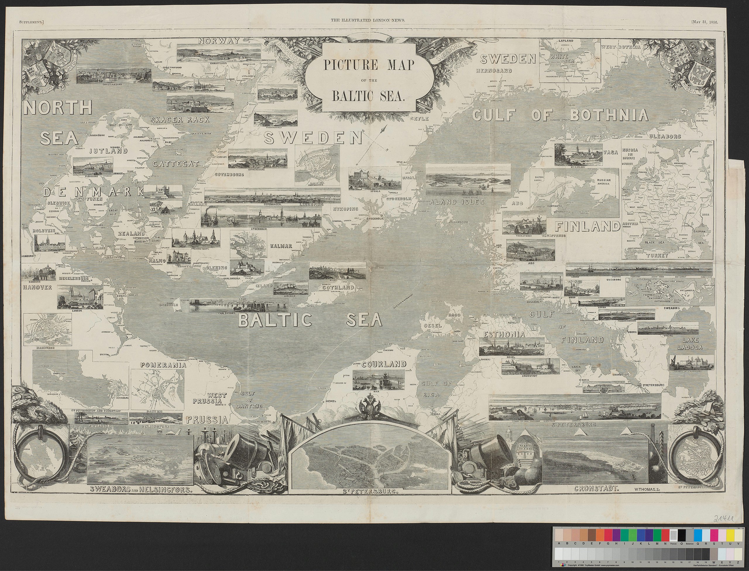
Picture Map of the Baltic Sea from the Illustrated London News May 31, 1856
Summary edit
| Warning | The original file is very high-resolution. It might not load properly or could cause your browser to freeze when opened at full size. |
|---|
| Description |
English: Picture Map of the Baltic Sea from the Illustrated London News May 31, 1856, kept in Schaufenster Kartensammlung Gottfried Wilhelm Leibniz Bibliothek |
|||||||||
| Source | https://ku-ni.de/record_kuniweb_1366128 | |||||||||
| Creator |
The Illustrated London News |
|||||||||
| Geotemporal data | ||||||||||
| Date depicted | ||||||||||
| Bounding box |
|
|||||||||
| Georeferencing | ||||||||||
Licensing edit
| This file is made available under the Creative Commons CC0 1.0 Universal Public Domain Dedication. | |
| The person who associated a work with this deed has dedicated the work to the public domain by waiving all of their rights to the work worldwide under copyright law, including all related and neighboring rights, to the extent allowed by law. You can copy, modify, distribute and perform the work, even for commercial purposes, all without asking permission.
|
File history
Click on a date/time to view the file as it appeared at that time.
| Date/Time | Thumbnail | Dimensions | User | Comment | |
|---|---|---|---|---|---|
| current | 10:12, 12 March 2020 | | 10,909 × 8,319 (16.73 MB) | Puik (talk | contribs) | Uploaded a work by The Illustrated London News from https://ku-ni.de/record_kuniweb_1366128 with UploadWizard |
You cannot overwrite this file.
File usage on Commons
There are no pages that use this file.