File:1857 U.S. Coast Survey Map of Cape Cod, Nantucket, and Martha's Vineyard - Geographicus - CapeCod-uscs-1857.jpg
Original file (6,000 × 5,508 pixels, file size: 5.92 MB, MIME type: image/jpeg)
Captions
Captions
| Preliminary Chart No. 4 of the Sea Coast of the United States from Plymouth Mass. To Saughkonnet River R. I. | ||||||
|---|---|---|---|---|---|---|
| Artist | ||||||
| Title |
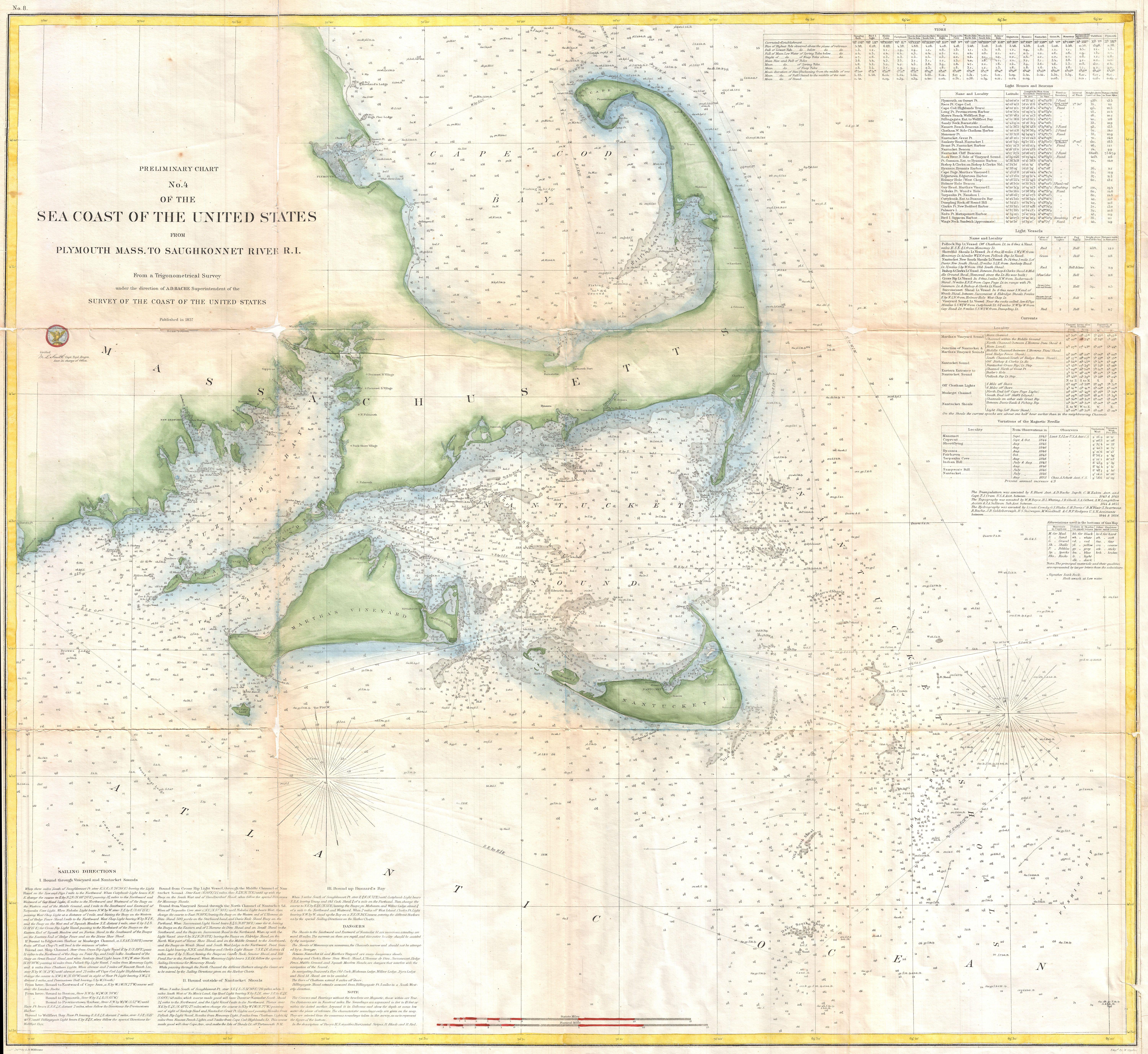
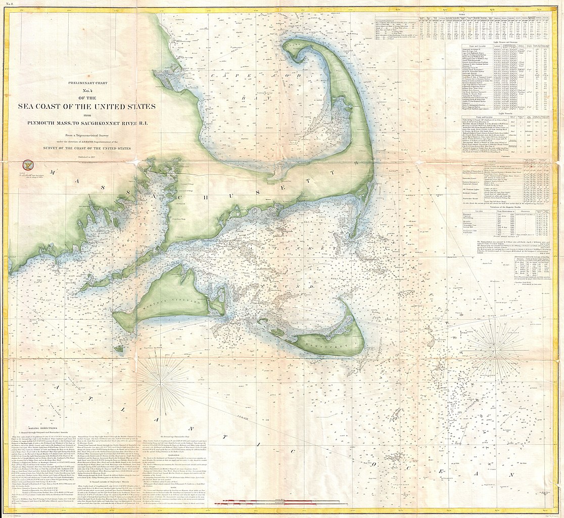
Preliminary Chart No. 4 of the Sea Coast of the United States from Plymouth Mass. To Saughkonnet River R. I. |
|||||
| Description |
English: A rare 1857 nautical chart of the Massachusetts coast from Plymouth, MA to Saughkonnet River, RI. Includes Barnstable county, Cape Cod, Nantucket, and Martha's Vineyard. Offers minimal inland detail but a wealth of nautical information including countless depth sounding and notations on the many offshore shoals and other dangers in the region. The upper right quadrant features extensive notations on tides and light houses. Sailing directions appear in the lower left quadrant. Published under the supervision of A. D. Bache for the 1853 Report of the Superintendent of the U.S. Coast Survey . |
|||||
| Date | 1857 (dated) | |||||
| Dimensions | height: 29 in (73.6 cm); width: 32 in (81.2 cm) | |||||
| Accession number |
Geographicus link: CapeCod-uscs-1857 |
|||||
| Source/Photographer |
Report of the Superintendant of the United States Coast Survey, Washington, (1857 edition).
|
|||||
| Permission (Reusing this file) |
|
|||||
| Object location | | View this and other nearby images on: OpenStreetMap |
|---|
File history
Click on a date/time to view the file as it appeared at that time.
| Date/Time | Thumbnail | Dimensions | User | Comment | |
|---|---|---|---|---|---|
| current | 13:28, 24 March 2011 | | 6,000 × 5,508 (5.92 MB) | BotMultichillT (talk | contribs) | {{subst:User:Multichill/Geographicus |link=http://www.geographicus.com/P/AntiqueMap/CapeCod-uscs-1857 |product_name=1857 U.S. Coast Survey Map of Cape Cod, Nantucket, and Martha's Vineyard |map_title=Preliminary Chart No. 4 of the Sea Coast of the United |
You cannot overwrite this file.
File usage on Commons
The following page uses this file: