File:1872 Colton Map of the North Pole or Arctic - Geographicus - NorthPole-colton-1872.jpg
Size of this preview: 492 × 600 pixels. Other resolutions: 197 × 240 pixels | 394 × 480 pixels | 630 × 768 pixels | 840 × 1,024 pixels | 1,680 × 2,048 pixels | 3,500 × 4,266 pixels.
Original file (3,500 × 4,266 pixels, file size: 4.46 MB, MIME type: image/jpeg)
Captions
Captions
Add a one-line explanation of what this file represents
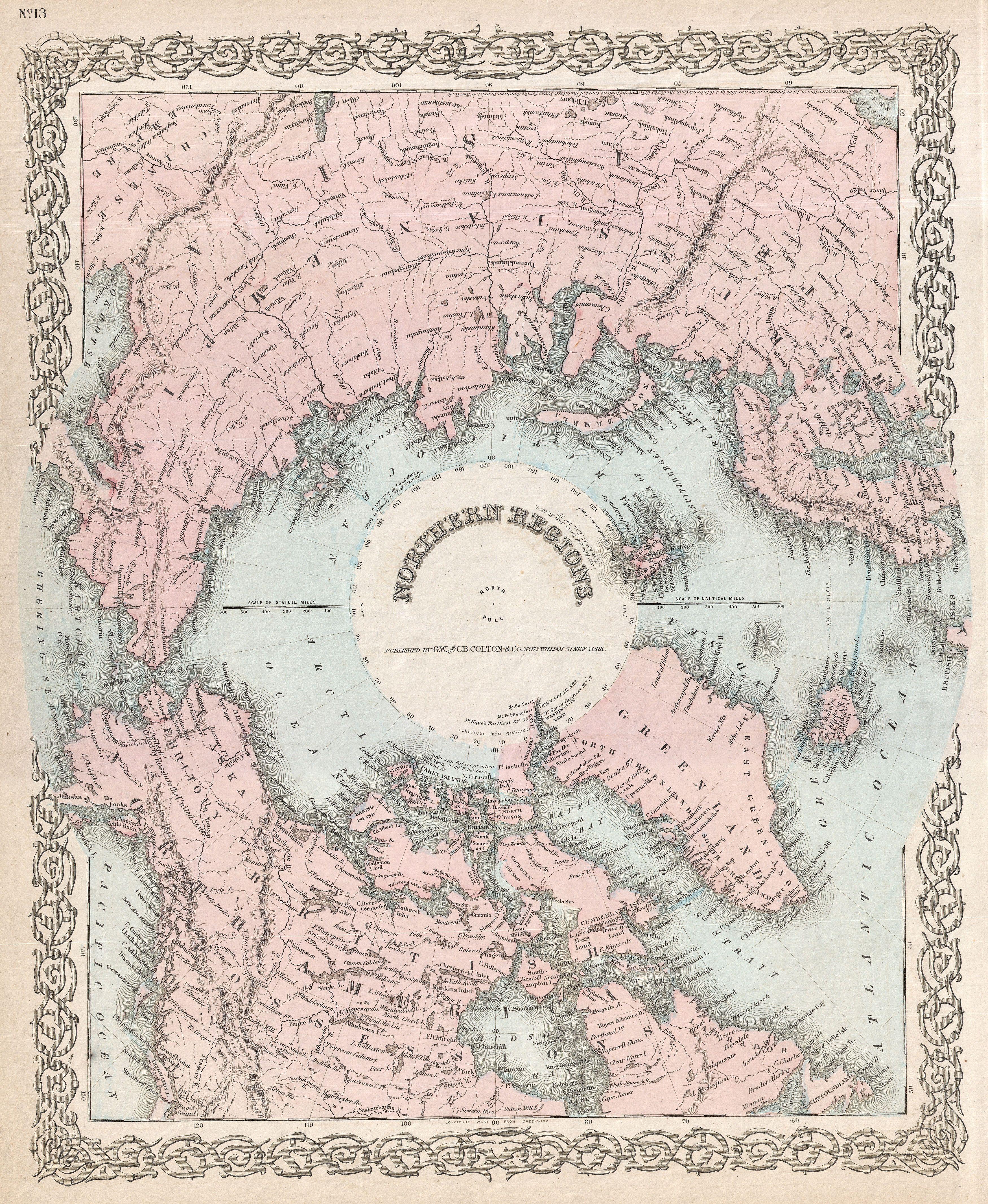
| J. H. Colton: Northern Regions.
( |
|||||||||||||||||||||
|---|---|---|---|---|---|---|---|---|---|---|---|---|---|---|---|---|---|---|---|---|---|
| Artist |
|
||||||||||||||||||||
| Title |
Northern Regions. |
||||||||||||||||||||
| Description |
English: A rarely seen variant state of Colton’s map of the North Pole or Arctic. Covers from Lake Baikal, the Hudson Bay, the British Isles and Kamchatka north to the Pole. Generally gives an excellent overview of the state Arctic exploration and discovery to about 1855. Though this map is not significantly different from earlier editions - the only notable plate change is the replacement of J.H. Colton's imprint with teh G.W. and C.B. Colton imprint - however it is unique in that color has been added. All previous editions of this map were in black and white. Prepared by G. W. and C. B. Colton as map no. 13 in the 1872 edition of Colton's Atlas of The World. |
||||||||||||||||||||
| Date | 1872 (dated 1855) | ||||||||||||||||||||
| Dimensions | height: 16.5 in (41.9 cm); width: 13.5 in (34.2 cm) | ||||||||||||||||||||
| Accession number |
Geographicus link: NorthPole-colton-1872 |
||||||||||||||||||||
| Source/Photographer |
Colton, G.W. & C.B., Colton's Atlas Of The World, Illustrating Physical And Political Geography., (1872 editon).
|
||||||||||||||||||||
| Permission (Reusing this file) |
|
||||||||||||||||||||

File history
Click on a date/time to view the file as it appeared at that time.
| Date/Time | Thumbnail | Dimensions | User | Comment | |
|---|---|---|---|---|---|
| current | 03:42, 23 March 2011 | | 3,500 × 4,266 (4.46 MB) | BotMultichillT (talk | contribs) | {{subst:User:Multichill/Geographicus |link=http://www.geographicus.com/P/AntiqueMap/NorthPole-colton-1872 |product_name=1872 Colton Map of the North Pole or Arctic |map_title=Northern Regions. |description=A rarely seen variant state of Colton’s map of |
You cannot overwrite this file.
File usage on Commons
The following page uses this file: