File:1874 U.S.C.S. Map or Chart of Lake Champlain ( Burlington, VT ) - Geographicus - LakeChamplain2-uscs-1874.jpg
Original file (4,410 × 6,000 pixels, file size: 3.5 MB, MIME type: image/jpeg)
Captions
Captions
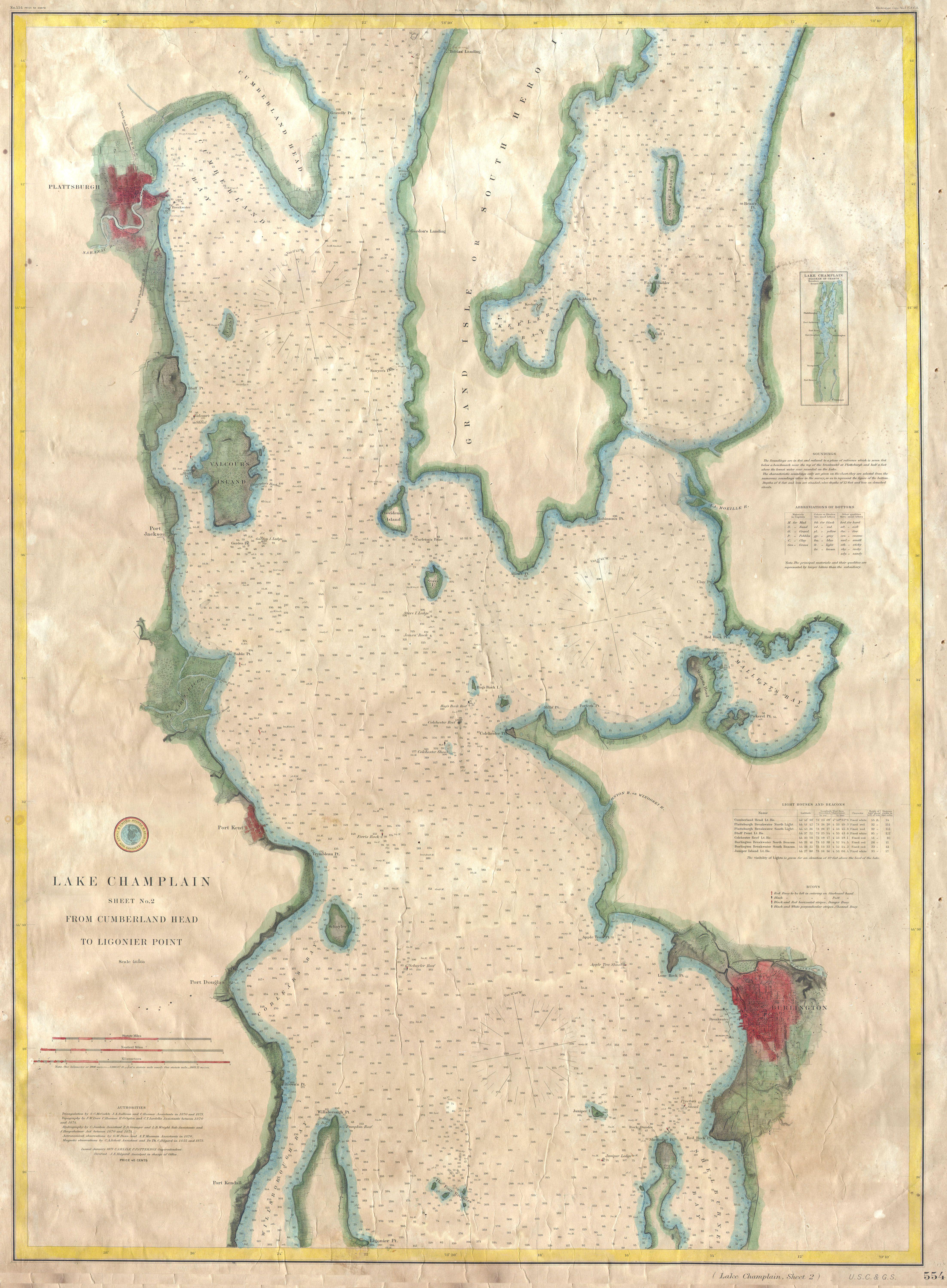
| Lake Champlain Sheet No. 2 from Cumberland Head to Ligonier Point. | ||||||
|---|---|---|---|---|---|---|
| Artist | ||||||
| Title |
Lake Champlain Sheet No. 2 from Cumberland Head to Ligonier Point. |
|||||
| Description |
English: A rare hand colored 1874 coastal chart of the northern part of Lake Champlain from Cumberland Head to Ligonier Point. Includes the cities of Burlington, Vermont and Plattsburgh, New York. The map features sailing instructions and hundreds of depth soundings throughout. Unlike most maps published by the U.S.C.S., this map was never issued to be folded in a book. Rather, it is an extremely rare independent issue for actual nautical use. Backed with old linen. Published under the supervision of H. D. Ogden. |
|||||
| Date | 1874 | |||||
| Dimensions | height: 27 in (68.5 cm); width: 37 in (93.9 cm) | |||||
| Accession number |
Geographicus link: LakeChamplain2-uscs-1874 |
|||||
| Source/Photographer |
|
|||||
| Permission (Reusing this file) |
|
|||||
File history
Click on a date/time to view the file as it appeared at that time.
| Date/Time | Thumbnail | Dimensions | User | Comment | |
|---|---|---|---|---|---|
| current | 17:02, 24 March 2011 | | 4,410 × 6,000 (3.5 MB) | BotMultichillT (talk | contribs) | {{subst:User:Multichill/Geographicus |link=http://www.geographicus.com/P/AntiqueMap/LakeChamplain2-uscs-1874 |product_name=1874 U.S.C.S. Map or Chart of Lake Champlain ( Burlington, VT ) |map_title=Lake Champlain Sheet No. 2 from Cumberland Head to Ligoni |
You cannot overwrite this file.
File usage on Commons
The following page uses this file:
_-_Geographicus_-_LakeChamplain2-uscs-1874.jpg)
_-_Geographicus_-_LakeChamplain2-uscs-1874.jpg&oldid=745906058)