File:1874 U.S. Coast Survey Map of the Neuse River, North Carolina - Geographicus - NeuseRiverNorthCarolina-uscs-1874.jpg
Original file (5,000 × 3,632 pixels, file size: 3.97 MB, MIME type: image/jpeg)
Captions
Captions
| Neuse River North Carolina. | ||||||
|---|---|---|---|---|---|---|
| Artist | ||||||
| Title |
Neuse River North Carolina. |
|||||
| Description |
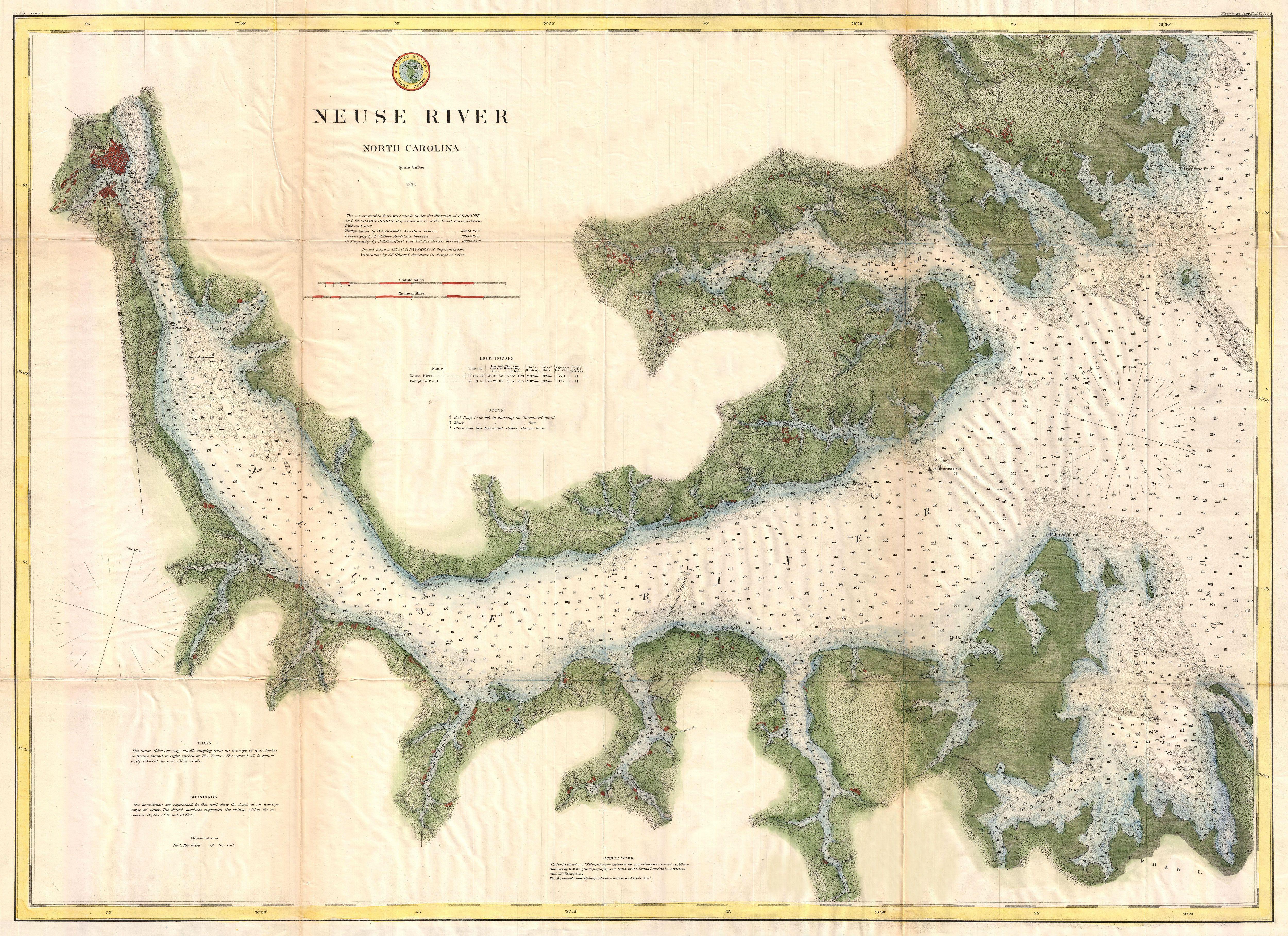
English: A very attractive example of the 1874 U.S. Coast Survey nautical chart or map of the Neuse River, North Carolina. This map covers the Neuse River from New Berne, North Carolina, eastward as far as the river’s mouth in the Pamlico Sound. The Neuse River’s numerous estuaries are noted as are various hamlets, farms, and triangulation points on the river’s banks. Offers exceptional if limited inland detail with important building, streets, and some farms. In both the Pamlico Sound and the Neuse River itself there are countless depth soundings as well as notes on reefs and shoals. This map was surveyed during the tenure of A. D. Bache as Superintendent of the Survey but was produced under the supervision his successor, Benjamin Peirce. |
|||||
| Date | 1874 (dated) | |||||
| Dimensions | height: 23 in (58.4 cm); width: 32 in (81.2 cm) | |||||
| Accession number |
Geographicus link: NeuseRiverNorthCarolina-uscs-1874 |
|||||
| Source/Photographer |
Report of the Superintendent of the United States Coast Survey, (Washington) 1874.
|
|||||
| Permission (Reusing this file) |
|
|||||
File history
Click on a date/time to view the file as it appeared at that time.
| Date/Time | Thumbnail | Dimensions | User | Comment | |
|---|---|---|---|---|---|
| current | 06:41, 25 March 2011 | | 5,000 × 3,632 (3.97 MB) | BotMultichillT (talk | contribs) | {{subst:User:Multichill/Geographicus |link=http://www.geographicus.com/P/AntiqueMap/NeuseRiverNorthCarolina-uscs-1874 |product_name=1874 U.S. Coast Survey Map of the Neuse River, North Carolina |map_title=Neuse River North Carolina. |description=A very at |
You cannot overwrite this file.
File usage on Commons
The following page uses this file: