File:1882 U.S. Coast Survey Map of Beaufort, South Carolina - Geographicus - Beaufort-uscs-1882.jpg
Size of this preview: 487 × 599 pixels. Other resolutions: 195 × 240 pixels | 390 × 480 pixels | 624 × 768 pixels | 832 × 1,024 pixels | 1,664 × 2,048 pixels | 3,500 × 4,307 pixels.
Original file (3,500 × 4,307 pixels, file size: 3.78 MB, MIME type: image/jpeg)
Captions
Captions
Add a one-line explanation of what this file represents
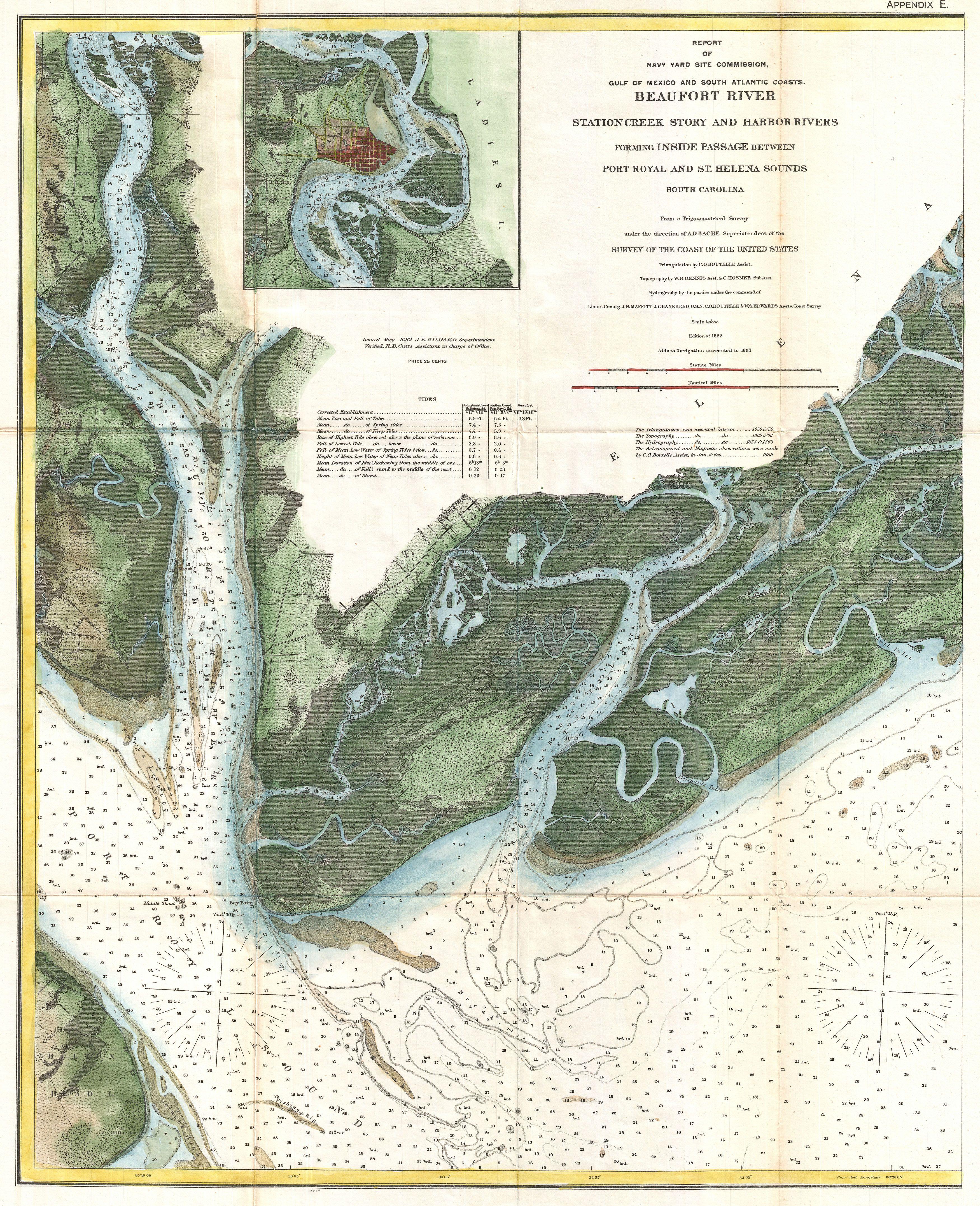
| Beaufort River Station Creek Story and Harbor Rivers Forming Inside Passage Between Port Royal and St. Helena Sounds South Carolina | |||||||
|---|---|---|---|---|---|---|---|
| Artist | |||||||
| Title |
Beaufort River Station Creek Story and Harbor Rivers Forming Inside Passage Between Port Royal and St. Helena Sounds South Carolina |
||||||
| Description |
English: A beautiful example of the 1882 U.S. Coast Survey chart or map of the Beaufort River, South Carolina. Covers from Port Royal Island to Hilton Head and east as far as Skill Inlet on Pritchard Island. Offers stunning inland detail as well as thousands of depth sounding. An inset of Beaufort, considered one of the most beautiful towns in South Carolina, appears in the upper left quadrant. The triangulation for this chart was completed by C. G. Boutelle. The topography is the work of W. H. Dennis and C. Hosmer. The Hydrography was completed by a party under the command of J. N. Maffit, J.F. Bankhead, C. O. Boutelle and W. S. Edwards. The original chart, which appeared in 1864, was produced under A. D. Bache, superintendent of the Survey. This edition has been updated to 1882 under the supervision of J.K Hilgard and J. D. Cutts. |
||||||
| Date | 1882 (dated) | ||||||
| Dimensions | height: 22.5 in (57.1 cm); width: 18.5 in (46.9 cm) | ||||||
| Accession number |
Geographicus link: Beaufort-uscs-1882 |
||||||
| Source/Photographer |
|
||||||
| Permission (Reusing this file) |
|
||||||

File history
Click on a date/time to view the file as it appeared at that time.
| Date/Time | Thumbnail | Dimensions | User | Comment | |
|---|---|---|---|---|---|
| current | 00:00, 24 March 2011 | | 3,500 × 4,307 (3.78 MB) | BotMultichillT (talk | contribs) | {{subst:User:Multichill/Geographicus |link=http://www.geographicus.com/P/AntiqueMap/Beaufort-uscs-1882 |product_name=1882 U.S. Coast Survey Map of Beaufort, South Carolina |map_title=Beaufort River Station Creek Story and Harbor Rivers Forming Inside Pass |
You cannot overwrite this file.
File usage on Commons
The following page uses this file:
File usage on other wikis
The following other wikis use this file:
- Usage on en.wikipedia.org
- Usage on fr.wikipedia.org