File:1895 Bien Map of New York City (w- Queens ^ the Bronx) - Geographicus - NYC-bien-1895.jpg

Size of this preview: 423 × 599 pixels. Other resolutions: 169 × 240 pixels | 339 × 480 pixels | 542 × 768 pixels | 723 × 1,024 pixels | 1,447 × 2,048 pixels | 3,532 × 5,000 pixels.
Original file (3,532 × 5,000 pixels, file size: 3.73 MB, MIME type: image/jpeg)
Captions
Captions
Add a one-line explanation of what this file represents
| City of New York. | ||||
|---|---|---|---|---|
| Artist | ||||
| Title |
City of New York. |
|||
| Description |
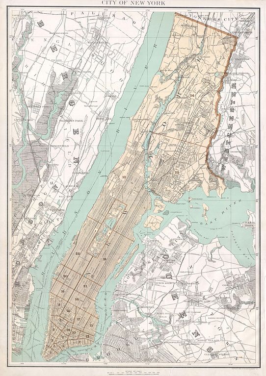
English: A beautiful 1895 large format map of New York City by Joseph Rudolph Bien. Depicts the borough of Mahattan, Queens, and the Bronx as far as Yonkers and Westchester. Features good detail of the streets, trains, and parks as well as ferry routes and piers. Bien’s Atlas of New York was issued as an elephant folio and there is consequently no centerfold. Prepared for inclusion in the 1895 edition of Joseph Bien’s Atlas of New York State. An important piece for collectors of New York City cartography. |
|||
| Date | 1895 (undated) | |||
| Dimensions | height: 24 in (60.9 cm); width: 16.5 in (41.9 cm) | |||
| Accession number |
Geographicus link: NYC-bien-1895 |
|||
| Source/Photographer |
|
|||
| Permission (Reusing this file) |
|
|||
File history
Click on a date/time to view the file as it appeared at that time.
| Date/Time | Thumbnail | Dimensions | User | Comment | |
|---|---|---|---|---|---|
| current | 21:32, 24 March 2011 | | 3,532 × 5,000 (3.73 MB) | BotMultichillT (talk | contribs) | {{subst:User:Multichill/Geographicus |link=http://www.geographicus.com/P/AntiqueMap/NYC-bien-1895 |product_name=1895 Bien Map of New York City (w/ Queens & the Bronx) |map_title=City of New York. |description=A beautiful 1895 large format map of New York |
You cannot overwrite this file.
File usage on Commons
The following 2 pages use this file:
_-_Geographicus_-_NYC-bien-1895.jpg)
File usage on other wikis
The following other wikis use this file:
- Usage on en.wikipedia.org
- Usage on es.wikipedia.org
_-_Geographicus_-_NYC-bien-1895.jpg&oldid=746329945)