File:1910 Cheshire ordnance survey map showing Edgeley Park (cropped).jpg

Size of this preview: 492 × 600 pixels. Other resolutions: 197 × 240 pixels | 394 × 480 pixels | 630 × 768 pixels | 840 × 1,024 pixels | 2,282 × 2,782 pixels.
Original file (2,282 × 2,782 pixels, file size: 1.53 MB, MIME type: image/jpeg)
Captions
Captions
Add a one-line explanation of what this file represents
Summary edit
| Description |
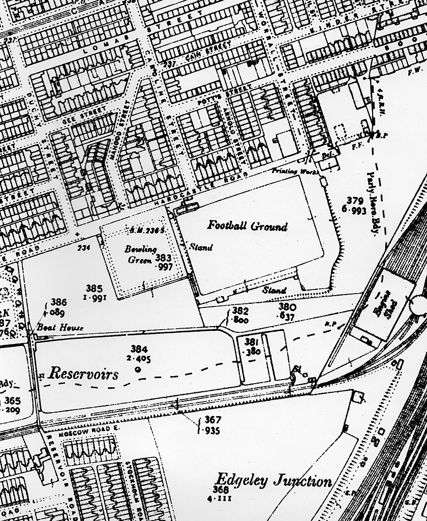
English: This is a scanned copy of the 1910 Ordnance survey of Edgeley, Stockport and pictures Edgeley Park Football Stadium, residential houses and a train line |
| Date | |
| Source | 1910 cheshire ordnance survey |
| Author | United Kingdom Ordnance Survey |
| Other versions |

.jpg&action=edit§ion=1)
Reproduced with the permission of the National Library of Scotland - https://maps.nls.uk/copyright.html#exceptions
Licensing edit
.jpg&action=edit§ion=2)
This file is licensed under the Creative Commons Attribution-Share Alike 4.0 International license.
- You are free:
- to share – to copy, distribute and transmit the work
- to remix – to adapt the work
- Under the following conditions:
- attribution – You must give appropriate credit, provide a link to the license, and indicate if changes were made. You may do so in any reasonable manner, but not in any way that suggests the licensor endorses you or your use.
- share alike – If you remix, transform, or build upon the material, you must distribute your contributions under the same or compatible license as the original.
This work is an Ordnance Survey map over 50 years old, which is covered by Crown Copyright which in this case expires 50 years after publication. Ordnance Survey does however ask that they be credited and that the date of publication be given.
Any ancillary rights gained through the creation of the electronic version are granted as freely usable under any circumstances.
|
This work created by the United Kingdom Government is in the public domain.
This is because it is one of the following:
HMSO has declared that the expiry of Crown Copyrights applies worldwide (ref: HMSO Email Reply)
|
 |
File history
Click on a date/time to view the file as it appeared at that time.
| Date/Time | Thumbnail | Dimensions | User | Comment | |
|---|---|---|---|---|---|
| current | 16:41, 26 May 2020 | | 2,282 × 2,782 (1.53 MB) | Wna247 (talk | contribs) | File:1910 cheshire odinance survey map showing Edgley Park.jpg cropped 23 % horizontally, 32 % vertically using CropTool with precise mode. |
You cannot overwrite this file.
File usage on Commons
The following page uses this file:
File usage on other wikis
The following other wikis use this file:
- Usage on en.wikipedia.org
- Usage on fr.wikipedia.org
- Usage on ja.wikipedia.org
.jpg&oldid=746547290)