File:1926 base revised 4.png
(Redirected from File:1926 base revised 4.gif)

Size of this preview: 798 × 599 pixels. Other resolutions: 320 × 240 pixels | 639 × 480 pixels | 1,023 × 768 pixels | 1,280 × 962 pixels | 2,078 × 1,561 pixels.
Original file (2,078 × 1,561 pixels, file size: 508 KB, MIME type: image/png)
Captions
Captions
Add a one-line explanation of what this file represents
Summary edit
| Description |
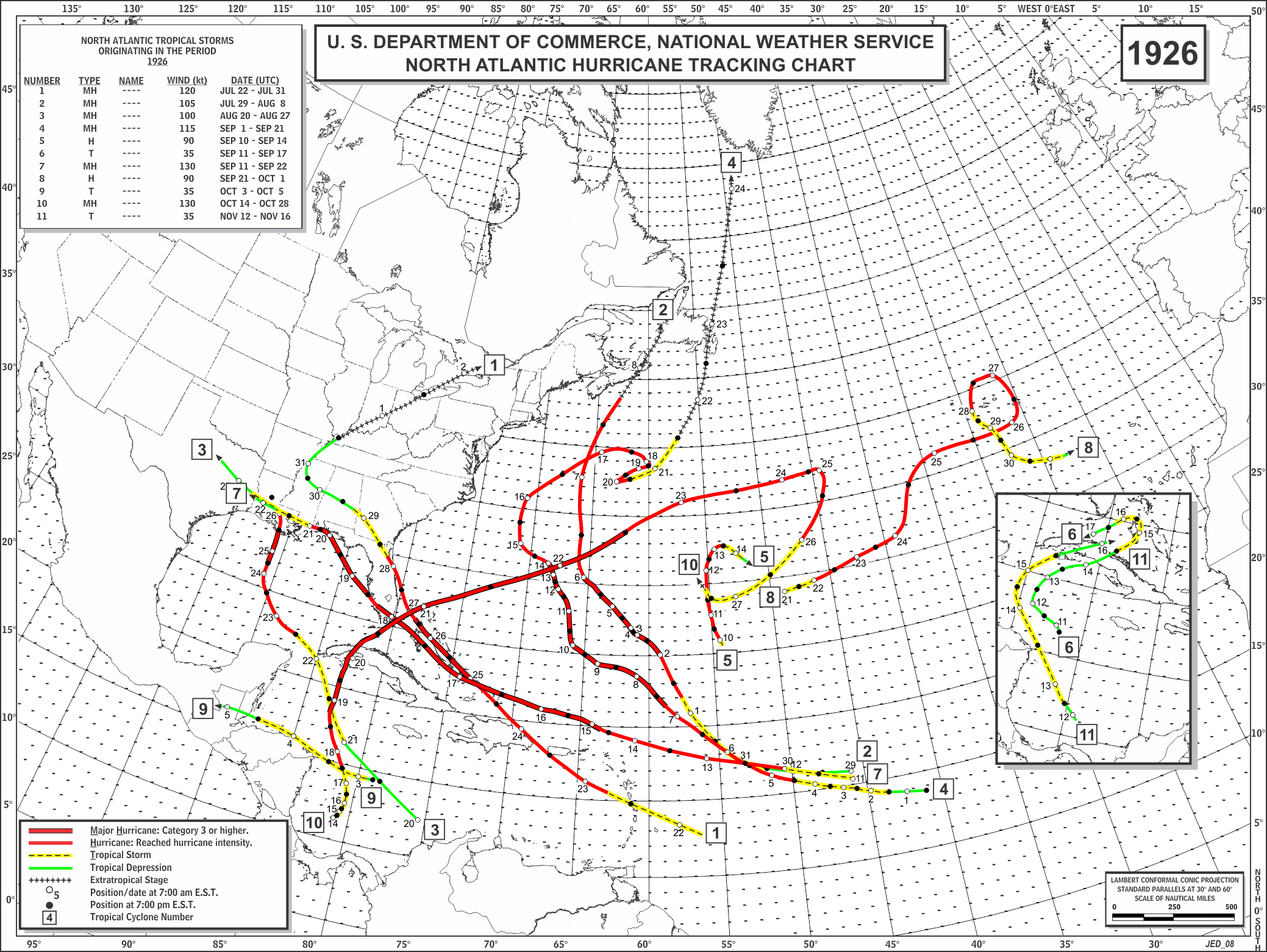
English: Track map of the 1926 Atlantic hurricane season after re-analysis |
|||
| Date |
2012-09-07 |
|||
| Source |
|
|||
| Author |
Hurricane Research Division. National Hurricane Center |
|||
| Permission (Reusing this file) |
|
Licensing edit
This image is in the public domain because it contains materials that originally came from the U.S. National Oceanic and Atmospheric Administration, taken or made as part of an employee's official duties.
|
Original upload log edit
| Date/Time | Dimensions | User | Comment |
|---|---|---|---|
| 8 September 2012, 01:37:31 | 2078 × 1561 (532051 bytes) | CapeVerdeWave (talk · contribs) | User created page with UploadWizard |
File history
Click on a date/time to view the file as it appeared at that time.
| Date/Time | Thumbnail | Dimensions | User | Comment | |
|---|---|---|---|---|---|
| current | 19:59, 19 July 2014 | | 2,078 × 1,561 (508 KB) | GifTagger (talk | contribs) | Bot: Converting file to superior PNG file. (Source: 1926_base_revised_4.gif). This GIF was problematic due to non-greyscale color table. |
You cannot overwrite this file.
File usage on Commons
The following page uses this file:
- File:1926 base revised 4.gif (file redirect)