File:1955 Brazilian presidential election map.svg

Size of this PNG preview of this SVG file: 563 × 506 pixels. Other resolutions: 267 × 240 pixels | 534 × 480 pixels | 855 × 768 pixels | 1,139 × 1,024 pixels | 2,279 × 2,048 pixels.
Original file (SVG file, nominally 563 × 506 pixels, file size: 810 KB)
Captions
Captions
Add a one-line explanation of what this file represents
Summary edit
| Description |
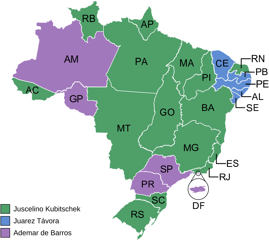
Português: Mapa de resultados da Eleição presidencial no Brasil em 1955.
English: Map of the 1955 Brazilian presidential election. |
| Date | |
| Source | 2010 Brazilian presidential election map (Round 1).svg |
| Author |
Source: Felipe Menegaz; Derivate work: Raafael |
.svg)
Licensing edit
This file is licensed under the Creative Commons Attribution-Share Alike 3.0 Unported license.
- You are free:
- to share – to copy, distribute and transmit the work
- to remix – to adapt the work
- Under the following conditions:
- attribution – You must give appropriate credit, provide a link to the license, and indicate if changes were made. You may do so in any reasonable manner, but not in any way that suggests the licensor endorses you or your use.
- share alike – If you remix, transform, or build upon the material, you must distribute your contributions under the same or compatible license as the original.
File history
Click on a date/time to view the file as it appeared at that time.
| Date/Time | Thumbnail | Dimensions | User | Comment | |
|---|---|---|---|---|---|
| current | 00:30, 8 November 2020 | | 563 × 506 (810 KB) | Raafael (talk | contribs) | Destaque para melhor visualização do Distrito Federal. |
| 23:29, 7 November 2020 |  | 563 × 506 (805 KB) | Raafael (talk | contribs) | Uploaded a work by '''Source:''' User:Felipe Menegaz;<br>'''Derivate work:''' User:Raafael from File:2010 Brazilian presidential election map (Round 1).svg with UploadWizard |
You cannot overwrite this file.
File usage on Commons
The following page uses this file:
File usage on other wikis
The following other wikis use this file:
- Usage on pt.wikipedia.org