File:196648012 Medicine Hat.svg

Size of this PNG preview of this SVG file: 328 × 567 pixels. Other resolutions: 139 × 240 pixels | 277 × 480 pixels | 444 × 768 pixels | 592 × 1,024 pixels | 1,185 × 2,048 pixels.
Original file (SVG file, nominally 328 × 567 pixels, file size: 619 KB)
Captions
Captions
Add a one-line explanation of what this file represents
Summary edit
| Description |
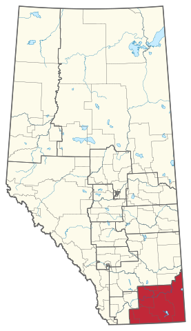
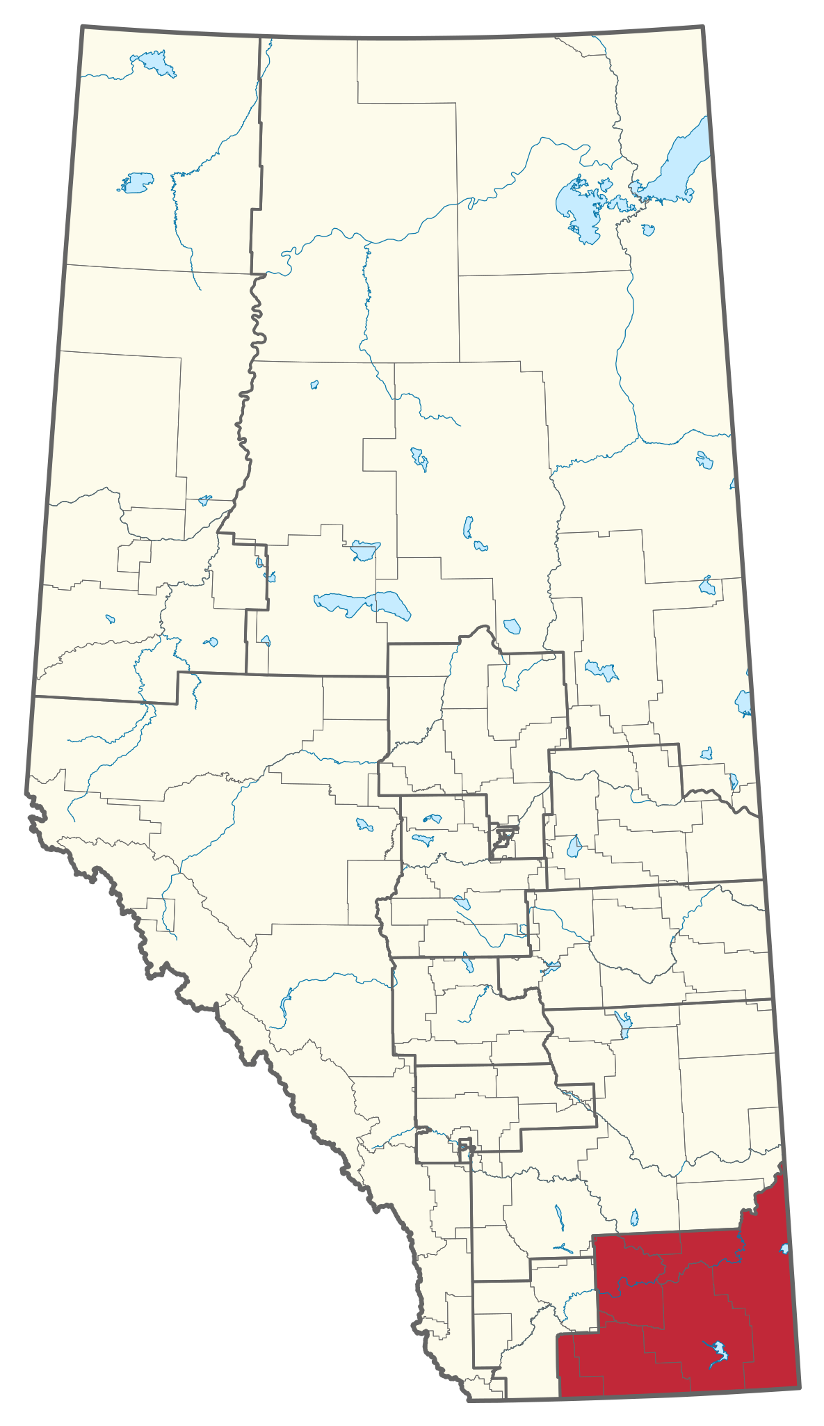
English: Map of Alberta federal ridings as they existed from 1966-1976. Lakes, rivers, and modern municipal boundaries shown for reference. Data by J.P. Kirby. |
| Date | |
| Source | Own work |
| Author | Alex McPhee |
Licensing edit
I, the copyright holder of this work, hereby publish it under the following license:
| This file is made available under the Creative Commons CC0 1.0 Universal Public Domain Dedication. | |
| The person who associated a work with this deed has dedicated the work to the public domain by waiving all of their rights to the work worldwide under copyright law, including all related and neighboring rights, to the extent allowed by law. You can copy, modify, distribute and perform the work, even for commercial purposes, all without asking permission.
|
File history
Click on a date/time to view the file as it appeared at that time.
| Date/Time | Thumbnail | Dimensions | User | Comment | |
|---|---|---|---|---|---|
| current | 22:10, 5 June 2023 | | 328 × 567 (619 KB) | Awmcphee (talk | contribs) | Uploaded own work with UploadWizard |
You cannot overwrite this file.
File usage on Commons
The following page uses this file: