File:1967 data of France.jpg

Size of this preview: 800 × 394 pixels. Other resolutions: 320 × 157 pixels | 640 × 315 pixels | 1,024 × 504 pixels | 1,280 × 630 pixels | 2,560 × 1,260 pixels | 5,847 × 2,877 pixels.
Original file (5,847 × 2,877 pixels, file size: 4.48 MB, MIME type: image/jpeg)
Captions
Captions
Add a one-line explanation of what this file represents
Summary
edit
| Description |
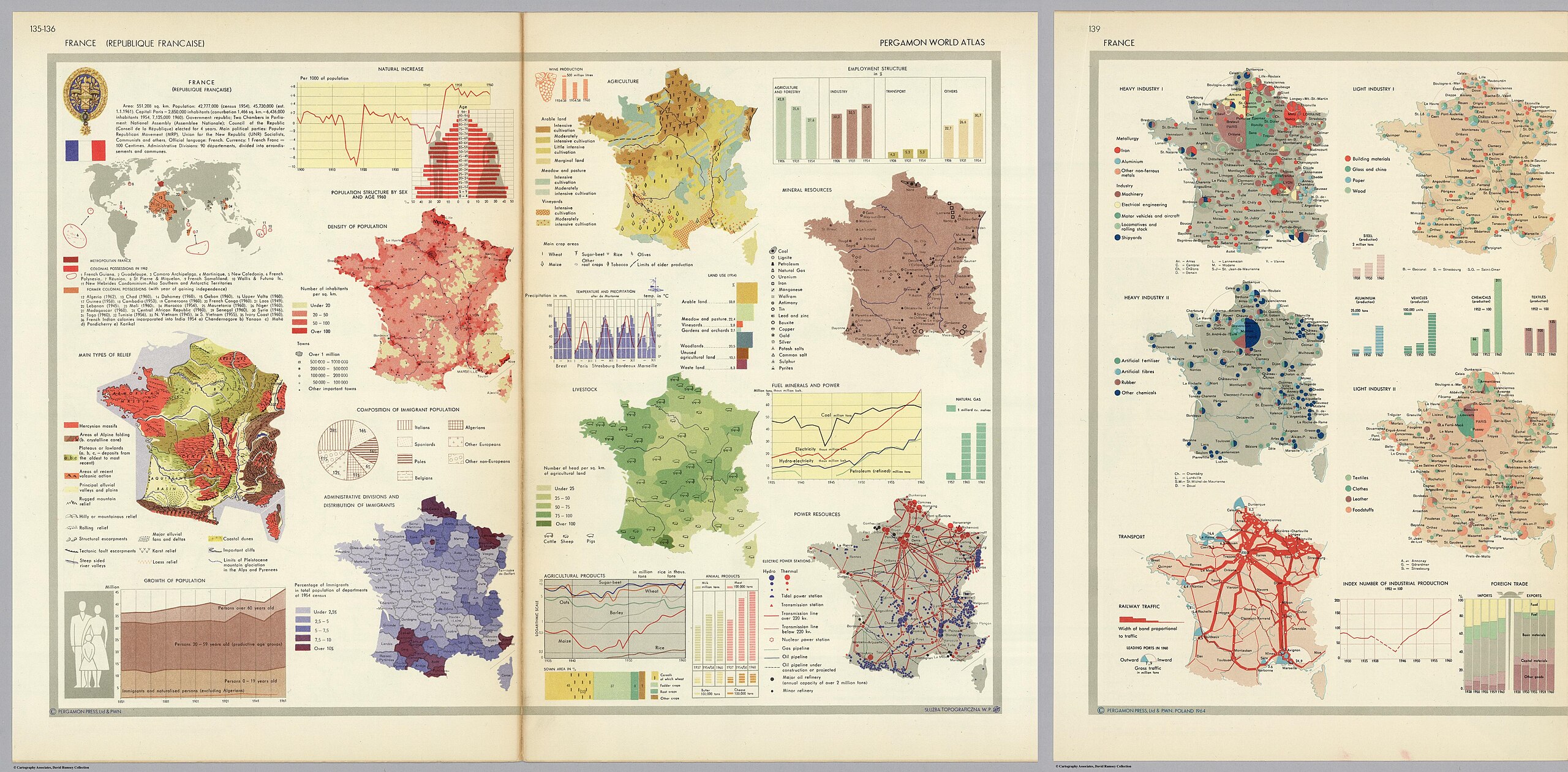
English: 28 small maps and graphics showing population, relief type, immigration, population density, agriculture, livestock, mineral resources, power, natural gas, industry, transport and foreign trade From Pergamon World Atlas |
| Date | |
| Source | David Rumsey Map Collection, list numbers 0737.093 and 0737.095 |
| Author | Polish Army Topography Service |
Licensing
edit
This file is licensed under the Creative Commons Attribution-Share Alike 3.0 Unported license.
- You are free:
- to share – to copy, distribute and transmit the work
- to remix – to adapt the work
- Under the following conditions:
- attribution – You must give appropriate credit, provide a link to the license, and indicate if changes were made. You may do so in any reasonable manner, but not in any way that suggests the licensor endorses you or your use.
- share alike – If you remix, transform, or build upon the material, you must distribute your contributions under the same or compatible license as the original.
File history
Click on a date/time to view the file as it appeared at that time.
| Date/Time | Thumbnail | Dimensions | User | Comment | |
|---|---|---|---|---|---|
| current | 20:07, 8 February 2024 | | 5,847 × 2,877 (4.48 MB) | Babelia (talk | contribs) | Uploaded a work by Polish Army Topography Service from David Rumsey Map Collection with UploadWizard |
You cannot overwrite this file.
File usage on Commons
There are no pages that use this file.