File:1970 NYNH&H map.png

Size of this preview: 737 × 599 pixels. Other resolutions: 295 × 240 pixels | 590 × 480 pixels | 944 × 768 pixels | 1,259 × 1,024 pixels | 2,518 × 2,048 pixels | 6,772 × 5,508 pixels.
Original file (6,772 × 5,508 pixels, file size: 1.84 MB, MIME type: image/png)
Captions
Captions
Add a one-line explanation of what this file represents
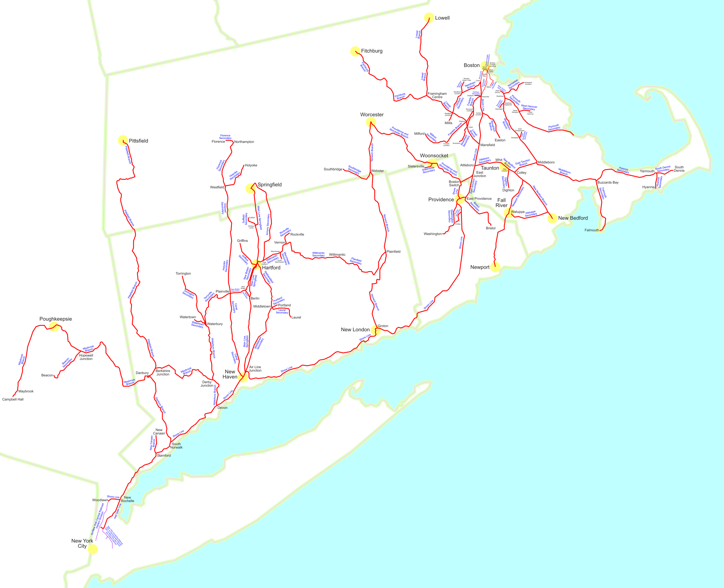
| Description | Geographic map of the former New York, New Haven and Hartford Railroad in early 1970, just over a year after it was merged into Penn Central. |
| Date | |
| Source | Own work |
| Author | User:SPUI |
| This work has been released into the public domain by its author, SPUI. This applies worldwide. In some countries this may not be legally possible; if so: |
File history
Click on a date/time to view the file as it appeared at that time.
| Date/Time | Thumbnail | Dimensions | User | Comment | |
|---|---|---|---|---|---|
| current | 00:17, 18 August 2005 | | 6,772 × 5,508 (1.84 MB) | SPUI~commonswiki (talk | contribs) | {{spuimap}} Map of the former New York, New Haven and Hartford Railroad in early 1970, just over a year after it was merged into Penn Central. Most information is from the maps on [http://pc.smellycat.com/maps/ttmaps/index.html]. [[category:railroad maps] |
You cannot overwrite this file.
File usage on Commons
There are no pages that use this file.