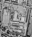
File:1988-1994 Aerial view Clouth area.png

Original file (1,515 × 1,748 pixels, file size: 1.56 MB, MIME type: image/png)
Captions
Captions
Summary edit
| Object location | 50° 57′ 55.27″ N, 6° 57′ 41.35″ E | View this and other nearby images on: OpenStreetMap |
|---|
Summary edit
| Description1988-1994 Aerial view Clouth area.png |
Deutsch: Luftbild des Clouth Geländes aufgenommen zwischen 1988 und 1994.
English: Aerial view of Clouth area taken between 1988 and 1994. |
| Date | |
| Source |
Land NRW (2018) Datenlizenz Deutschland -Namensnennung - Version 2.0 ([1]) Bezirksregierung Köln, Geobasis NRW, 50606 Köln |
| Author | Original aerial image from Land NRW, Bezirksregierung Köln. Image refined by Dr. Schorsch (talk) 20:39, 12 November 2018 (UTC) |
| Permission (Reusing this file) |
[Original permission https://www.bezreg-koeln.nrw.de/brk_internet/geobasis/lizenzbedingungen_geobasis_nrw.pdf] |
| Other versions |
|
| Geotemporal data | ||||||||||
| Bounding box |
|
|||||||||
| Georeferencing | View the georeferenced map in the Wikimaps Warper | |||||||||
Licensing edit

|
This file is licensed under the terms of the Data licence Germany – attribution – version 2.0 |
|
You are free:
Under the following conditions:
|
File history
Click on a date/time to view the file as it appeared at that time.
| Date/Time | Thumbnail | Dimensions | User | Comment | |
|---|---|---|---|---|---|
| current | 15:20, 3 April 2021 |  | 1,515 × 1,748 (1.56 MB) | Xorx (talk | contribs) | Higher resolution from same image source. Approx. 30 cm/Pixel |
| 21:24, 12 November 2018 |  | 754 × 878 (484 KB) | Xorx (talk | contribs) | {{Object Location|50.965354|6.961487}} =={{int:filedesc}}== {{Information |description={{de|1=Luftbild des Clouth Geländes aufgenommen zwischen 1988 und 1994.}} {{en|1=Aerial view of Clouth area taken between 1988 and 1994.}} |date=2018-11-12 |source=Land NRW (2018) Datenlizenz Deutschland -Namensnennung - Version 2.0 ([http://www.govdata.de/dl-de/by-2-0]) Bezirksregierung Köln, Geobasis NRW, 50606 Köln<br> |author=Original aerial image from Land NRW, Bezirksregierung Köln. Image refined... |
You cannot overwrite this file.
File usage on Commons
The following 4 pages use this file:
File usage on other wikis
The following other wikis use this file:
- Usage on de.wikipedia.org
- Usage on en.wikipedia.org
Metadata
This file contains additional information such as Exif metadata which may have been added by the digital camera, scanner, or software program used to create or digitize it. If the file has been modified from its original state, some details such as the timestamp may not fully reflect those of the original file. The timestamp is only as accurate as the clock in the camera, and it may be completely wrong.
| Horizontal resolution | 56.69 dpc |
|---|---|
| Vertical resolution | 56.69 dpc |
| File change date and time | 19:16, 3 April 2021 |


