File:19th Kum River Map2.JPG
Size of this preview: 768 × 600 pixels. Other resolutions: 308 × 240 pixels | 615 × 480 pixels | 984 × 768 pixels | 1,280 × 999 pixels | 1,500 × 1,171 pixels.
Original file (1,500 × 1,171 pixels, file size: 506 KB, MIME type: image/jpeg)
Captions
Captions
Add a one-line explanation of what this file represents
Summary edit
| Description |
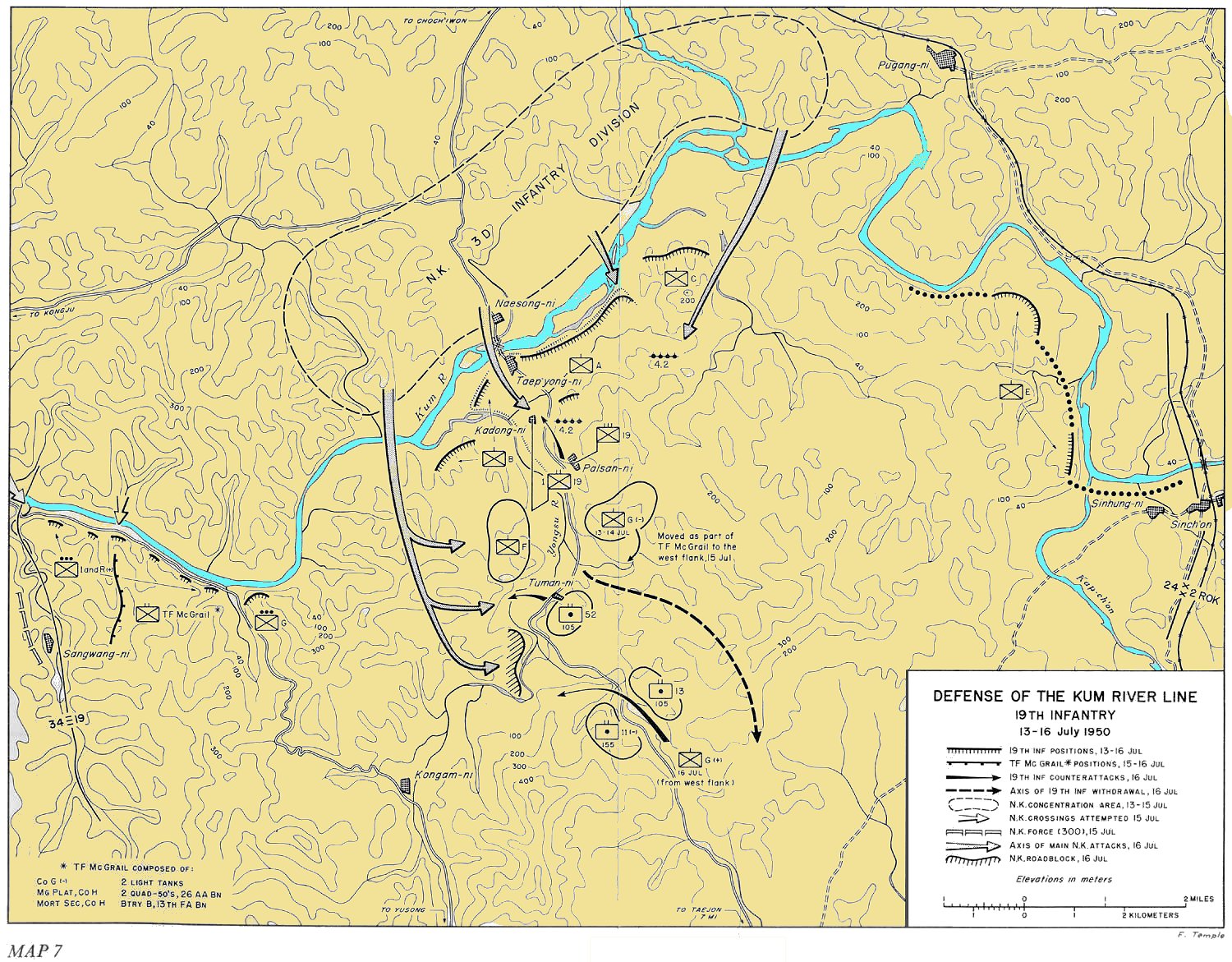
English: Defense of the Kum River Line, 19th Infantry - 13-16 July 1950 |
| Date | |
| Source | http://www.koreanwar.org/html/korean_war_maps_results.html?map_url=SNK_MAP_7_1500W, map as originally published in South to the Naktong, North to the Yalu by Roy Appleman, US Army historian (1992) |
| Author | Center of Military History, United States Army |
Licensing edit
This file is a work of a U.S. Army soldier or employee, taken or made as part of that person's official duties. As a work of the U.S. federal government, it is in the public domain in the United States.
|
 |
File history
Click on a date/time to view the file as it appeared at that time.
| Date/Time | Thumbnail | Dimensions | User | Comment | |
|---|---|---|---|---|---|
| current | 07:38, 9 April 2010 | | 1,500 × 1,171 (506 KB) | Ling.Nut (talk | contribs) | Trivially changed to add color. == Licensing == {{PD-USGov-Military-Army}} |
You cannot overwrite this file.
File usage on Commons
There are no pages that use this file.
File usage on other wikis
The following other wikis use this file:
- Usage on de.wikipedia.org
- Usage on en.wikipedia.org
- Usage on es.wikipedia.org
- Usage on fr.wikipedia.org
- Usage on it.wikipedia.org
- Usage on ja.wikipedia.org
- Usage on ko.wikipedia.org
- Usage on pt.wikipedia.org
- Usage on zh.wikipedia.org