File:2008-04-29 500-Millibar Height Contour Map NOAA.png
Size of this preview: 800 × 600 pixels. Other resolutions: 320 × 240 pixels | 640 × 480 pixels | 1,024 × 768 pixels | 1,039 × 779 pixels.
Original file (1,039 × 779 pixels, file size: 81 KB, MIME type: image/png)
Captions
Captions
Add a one-line explanation of what this file represents
Summary
edit
| Description |
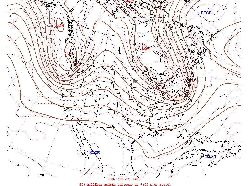
English: A 500-millibar height contour map for 29 April 2008. |
| Date | 29 April 2008 |
| Source | National Centers for Environmental Prediction |
| Author | National Centers for Environmental Prediction |
Licensing
edit
This image is in the public domain because it contains materials that originally came from the U.S. National Oceanic and Atmospheric Administration, taken or made as part of an employee's official duties.
|
File history
Click on a date/time to view the file as it appeared at that time.
| Date/Time | Thumbnail | Dimensions | User | Comment | |
|---|---|---|---|---|---|
| current | 17:06, 8 August 2013 | | 1,039 × 779 (81 KB) | Noaabot (talk | contribs) | == {{int:filedesc}} == {{NOAA-dailywxmap|type=dwm500_test|date=2008-04-29}} == {{int:license}} == {{PD-USGov-NOAA}} Category:2008 NCEP daily 500-millibar height contour maps Category:NCEP weather maps for April 2008 [[Category:NCEP daily 500-mi... |
You cannot overwrite this file.
File usage on Commons
There are no pages that use this file.