File:2008 Sichuan Earthquake aftershockes through May 28.pdf

Size of this JPG preview of this PDF file: 463 × 599 pixels. Other resolutions: 185 × 240 pixels | 371 × 480 pixels | 593 × 768 pixels | 1,275 × 1,650 pixels.
Original file (1,275 × 1,650 pixels, file size: 1.29 MB, MIME type: application/pdf)
Captions
Captions
Add a one-line explanation of what this file represents
Summary edit
| Description |
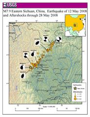
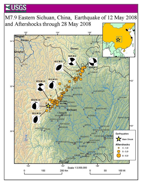
English: Map showing the location of the 2008 Sichuan earthquake and all the aftershocks following it through May 28, 2008 |
| Date | |
| Source | USGS |
| Author | USGS |
| Permission (Reusing this file) |
Public Domain |
Licensing edit
This image is in the public domain in the United States because it only contains materials that originally came from the United States Geological Survey, an agency of the United States Department of the Interior. For more information, see the official USGS copyright policy.
|
Original upload log edit
The original description page was here. All following user names refer to en.wikipedia.
- 2008-06-09 20:51 Cyclonebiskit 1275×1650× (1352464 bytes) {{Information |Description=Map showing the location of the 2008 Sichuan eathquake and all the aftershocks following it through May 28, 2008 |Source=[https://earthquake.usgs.gov/eqcenter/eqinthenews/2008/us2008ryan/#summary USGS] |Date=2008-6-1 |Author=USGS
File history
Click on a date/time to view the file as it appeared at that time.
| Date/Time | Thumbnail | Dimensions | User | Comment | |
|---|---|---|---|---|---|
| current | 21:55, 13 April 2014 |  | 1,275 × 1,650 (1.29 MB) | The Bushranger (talk | contribs) | Transferred from en.wikipedia |
You cannot overwrite this file.
File usage on Commons
There are no pages that use this file.
File usage on other wikis
The following other wikis use this file:
- Usage on en.wikipedia.org
- Usage on fi.wikipedia.org
- Usage on id.wikipedia.org
- Usage on mt.wikipedia.org
- Usage on sh.wikipedia.org
- Usage on sl.wikipedia.org
- Usage on zh.wikipedia.org