File:20100623 Paddepoelsterweg 11 (Hunzeroord) Groningen NL.jpg

Size of this preview: 800 × 533 pixels. Other resolutions: 320 × 213 pixels | 640 × 427 pixels | 1,024 × 683 pixels | 1,280 × 853 pixels | 2,700 × 1,800 pixels.
Original file (2,700 × 1,800 pixels, file size: 3.42 MB, MIME type: image/jpeg)
Captions
Captions
Add a one-line explanation of what this file represents
| Description |
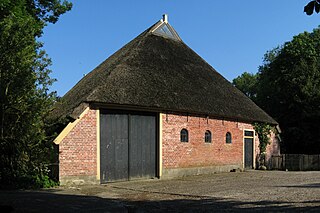
English: The farm Hunzeroord (1836) in the Dutch municipality of Groningen. Frysk: De eftergevel fan de pleats Hunzeroord, dy't yn de Koningslaagte oan de noardside fan it Van Starkenborghkanaal oan de Paddepoelsterweg yn de gemeente Grins stiet. It spul is yn 1836 setten as buorkerij en simmerferbliuw yn opdracht fan de Grinzer útfiner en heechleraar skiekunde Sibrandus Stratingh (1785-1841). Yn de grêft fan Hunzeroord makke Stratingh yn 1840 in proeffeart mei in troch him úttochte elektryske motorboat. De pleats is in ryksmonumint (rm 485367). Nederlands: De achtergevel van boerderij Hunzeroord (1836, rm 485367) aan de Paddepoelsterweg (Koningslaagte) in de gemeente Groningen. Het pand werd gebouwd in opdracht van de Groninger uitvinder en hoogleraar Sibrandus Stratingh (1785-1841).
|
||
| Date | |||
| Source | Own work | ||
| Author | |||
| Attribution (required by the license) | Wutsje / Wikimedia Commons / | ||
| Permission (Reusing this file) |
This file is licensed under the Creative Commons Attribution-Share Alike 3.0 Unported license.
|
| Camera location | | View this and other nearby images on: OpenStreetMap |
|---|
_Groningen_NL.jpg¶ms=053.253658_N_0006.524297_E_globe:Earth_type:camera_region:NL_heading:135.00&language=en)
File history
Click on a date/time to view the file as it appeared at that time.
| Date/Time | Thumbnail | Dimensions | User | Comment | |
|---|---|---|---|---|---|
| current | 12:25, 1 July 2010 | | 2,700 × 1,800 (3.42 MB) | Wutsje (talk | contribs) | {{Information |Description={{en|1=The farm ''Hunzeroord'' (1836) in the Dutch municipality of Groningen.}} {{fy|1=De eftergevel fan de pleats ''Hunzeroord'', dy't yn de ''Koningslaagte'' oan de noardside fan it [[:Category:V |
You cannot overwrite this file.
File usage on Commons
The following 3 pages use this file:
_Groningen_NL.jpg&redirect=no)
File usage on other wikis
The following other wikis use this file:
- Usage on nl.wikipedia.org
- Usage on www.wikidata.org
_Groningen_NL.jpg&oldid=857801777)