File:2012 District 4 Boston City Council electoral districts map.jpg

Size of this preview: 521 × 599 pixels. Other resolutions: 209 × 240 pixels | 607 × 698 pixels.
Original file (607 × 698 pixels, file size: 564 KB, MIME type: image/jpeg)
Captions
Captions
Add a one-line explanation of what this file represents
Summary edit
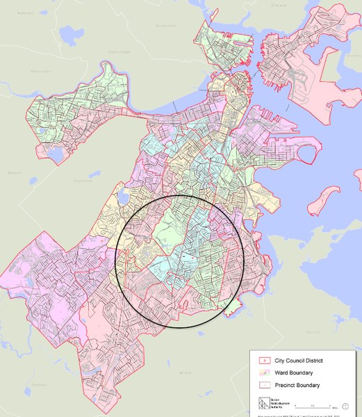
| Description | Boston City Council District 4 indicated on map of Boston "City Council Districts. 2012 Approved Plan. Last update 12/2012. 34 x 44"." Massachusetts, USA. |
| Date | |
| Source | Boston Redevelopment Authority / http://www.bostonredevelopmentauthority.org/research-maps/maps-and-gis/electoral-maps |
| Author | City of Boston |
Licensing edit
This file is licensed under the Creative Commons Attribution 3.0 Unported license.
- You are free:
- to share – to copy, distribute and transmit the work
- to remix – to adapt the work
- Under the following conditions:
- attribution – You must give appropriate credit, provide a link to the license, and indicate if changes were made. You may do so in any reasonable manner, but not in any way that suggests the licensor endorses you or your use.
File history
Click on a date/time to view the file as it appeared at that time.
| Date/Time | Thumbnail | Dimensions | User | Comment | |
|---|---|---|---|---|---|
| current | 11:04, 11 October 2014 | | 607 × 698 (564 KB) | M2545 (talk | contribs) | == {{int:filedesc}} == {{Information |Description=Boston City Council District 1 indicated on map of Boston "City Council Districts. 2012 Approved Plan. Last update 12/2012. 34 x 44"." Massachusetts, USA. |Source=Boston Redevelopment Authority / http:/... |
You cannot overwrite this file.
File usage on Commons
There are no pages that use this file.
File usage on other wikis
The following other wikis use this file:
- Usage on en.wikipedia.org