File:20130715 Walfridusbrug Van Starkenborghkanaal Groningen NL (2).jpg

Size of this preview: 600 × 600 pixels. Other resolutions: 240 × 240 pixels | 480 × 480 pixels | 768 × 768 pixels | 1,024 × 1,024 pixels | 2,500 × 2,500 pixels.
Original file (2,500 × 2,500 pixels, file size: 3.02 MB, MIME type: image/jpeg)
File information
Structured data
Captions
Captions
Add a one-line explanation of what this file represents
| Description20130715 Walfridusbrug Van Starkenborghkanaal Groningen NL (2).jpg |
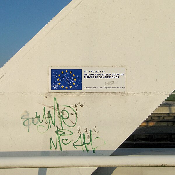
English: Detail of the Walfridus bridge (2003), a railway and bicycle bridge over the Van Starkenborghkanaal in the Dutch city of Groningen. The sign (in Dutch) says: Dit project is medegefinancierd door de Europese Gemeenschap / Europees Fonds voor Regionale ontwikkeling. (This project was partially funded by the European Community / European Regional Development Fund). Frysk: Detail fan de Walfridusbrêge (2003), de spoar- en fytsbrêge oer it Van Starkenborghkanaal en de Winsumerweg yn it noarden fan Grins, sjoen út it noarden wei. Oer de brêge rinne it spoar nei Delfsyl/Roodeschool en it Walfriduspad, it fytspaad de kant fan Adorp út. Nederlands: Detail van de Walfridusbrug (2003) over het Van Starkenborghkanaal en de Winsumerweg in de stad Groningen, gezien vanuit het noorden. Over de brug lopen de spoorlijnen naar Delfzijl en Roodeschool en het Walfriduspad, het fietspad in de richting Adorp. Over de brug lopen de spoorlijnen naar Delfzijl/Roodeschool en het Walfriduspad, het fietspad richting Adorp. |
| Date | |
| Source | Own work |
| Author | |
| Attribution (required by the license) InfoField | Wutsje / Wikimedia Commons / |
InfoField | Wutsje / Wikimedia Commons |
| Permission (Reusing this file) |
This file is licensed under the Creative Commons Attribution-Share Alike 3.0 Unported license.
|
| Other versions |
  |
| Camera location | 53° 14′ 34.4″ N, 6° 33′ 23.78″ E | View this and other nearby images on: OpenStreetMap |
|---|
File history
Click on a date/time to view the file as it appeared at that time.
| Date/Time | Thumbnail | Dimensions | User | Comment | |
|---|---|---|---|---|---|
| current | 18:43, 18 February 2014 |  | 2,500 × 2,500 (3.02 MB) | Wutsje (talk | contribs) | == {{int:filedesc}} == {{Information |Description= {{Multilingual description |en=Detail of the Walfridus bridge (2003), a railway and bicycle bridge over the [[:Category:Van Starkenborghkanaal|Van Starkenborghka... |
You cannot overwrite this file.
File usage on Commons
The following 4 pages use this file:
Metadata
This file contains additional information such as Exif metadata which may have been added by the digital camera, scanner, or software program used to create or digitize it. If the file has been modified from its original state, some details such as the timestamp may not fully reflect those of the original file. The timestamp is only as accurate as the clock in the camera, and it may be completely wrong.
| Exposure time | 1/400 sec (0.0025) |
|---|---|
| F-number | f/8 |
| ISO speed rating | 80 |
| Date and time of data generation | 19:25, 15 July 2013 |
| Lens focal length | 23.257456038059 mm |
| Image title | Detail van de Walfridusbrug (2003) over het Van Starkenborghkanaal en de Winsumerweg in de stad Groningen. Over de brug lopen de spoorlijnen naar Delfzijl en Roodeschool en het Walfriduspad, het fietspad in de richting Adorp. |
| Author | Wutsje |
| Credit/Provider | CC-BY-SA 3.0 - Wutsje |
| Source | Own work |
| Short title | De Walfridusbrug over het Van Starkenborghkanaal in de stad Groningen |
| City shown | Groningen |
| Copyright holder | CC-BY-SA 3.0 - Wutsje |
| JPEG file comment | CC-BY-SA 3.0 - Wutsje |
| Horizontal resolution | 300 dpi |
| Vertical resolution | 300 dpi |
| Software used | GIMP 2.8.6 |
| Exif version | 2.1 |
| Date and time of digitizing | 19:25, 15 July 2013 |
| Supported Flashpix version | 1 |
| Color space | sRGB |
| Sublocation of city shown | Van Starkenborghkanaal / Winsumerweg |
| Province or state shown | Groningen |
| Country shown | Nederland / The Netherlands |
| Keywords |
|