File:21st and P Streets, N.W..JPG

Size of this preview: 800 × 457 pixels. Other resolutions: 320 × 183 pixels | 640 × 365 pixels | 1,024 × 585 pixels | 1,280 × 731 pixels | 3,203 × 1,829 pixels.
Original file (3,203 × 1,829 pixels, file size: 3.11 MB, MIME type: image/jpeg)
Captions
Captions
Add a one-line explanation of what this file represents
| Description |
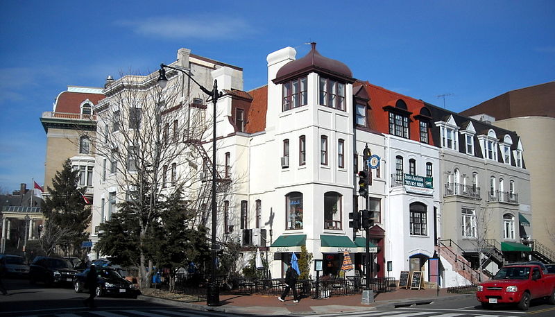
English: The northeast corner of 21st and P Streets, N.W., in the Dupont Circle neighborhood of Washington, D.C.
The former homes are designated as contributing properties to the Dupont Circle Historic District, listed on the National Register of Historic Places in 1978. The Embassy of Poland, Economic Section and Polish Library, and the Embassy of Indonesia are visible on the left-hand side. |
| Date | |
| Source | Own work |
| Author | AgnosticPreachersKid |
| Permission (Reusing this file) |
I, the copyright holder of this work, hereby publish it under the following license: This file is licensed under the Creative Commons Attribution-Share Alike 3.0 Unported license.
|
| Camera location | | View this and other nearby images on: OpenStreetMap |
|---|
File history
Click on a date/time to view the file as it appeared at that time.
| Date/Time | Thumbnail | Dimensions | User | Comment | |
|---|---|---|---|---|---|
| current | 05:43, 10 March 2010 | | 3,203 × 1,829 (3.11 MB) | APK (talk | contribs) | {{Information |Description={{en|The northeast corner of 21st and P Streets, N.W., in the Dupont Circle neighborhood of Washington, D.C. The former homes |
You cannot overwrite this file.
File usage on Commons
There are no pages that use this file.