File:22.30-san-pedro-de-atacama-MP0001050-cropped.pdf

Size of this JPG preview of this PDF file: 365 × 600 pixels. Other resolutions: 146 × 240 pixels | 292 × 480 pixels | 467 × 768 pixels | 623 × 1,024 pixels | 1,808 × 2,972 pixels.
Original file (1,808 × 2,972 pixels, file size: 4.89 MB, MIME type: application/pdf)
Captions
Captions
Add a one-line explanation of what this file represents
Summary edit
| Description |
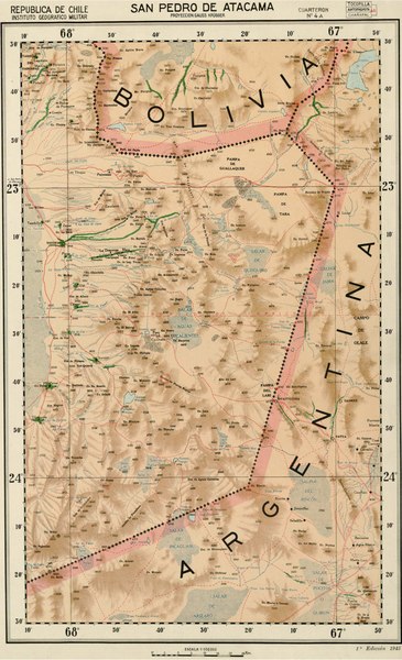
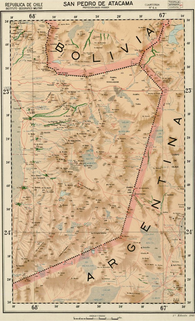
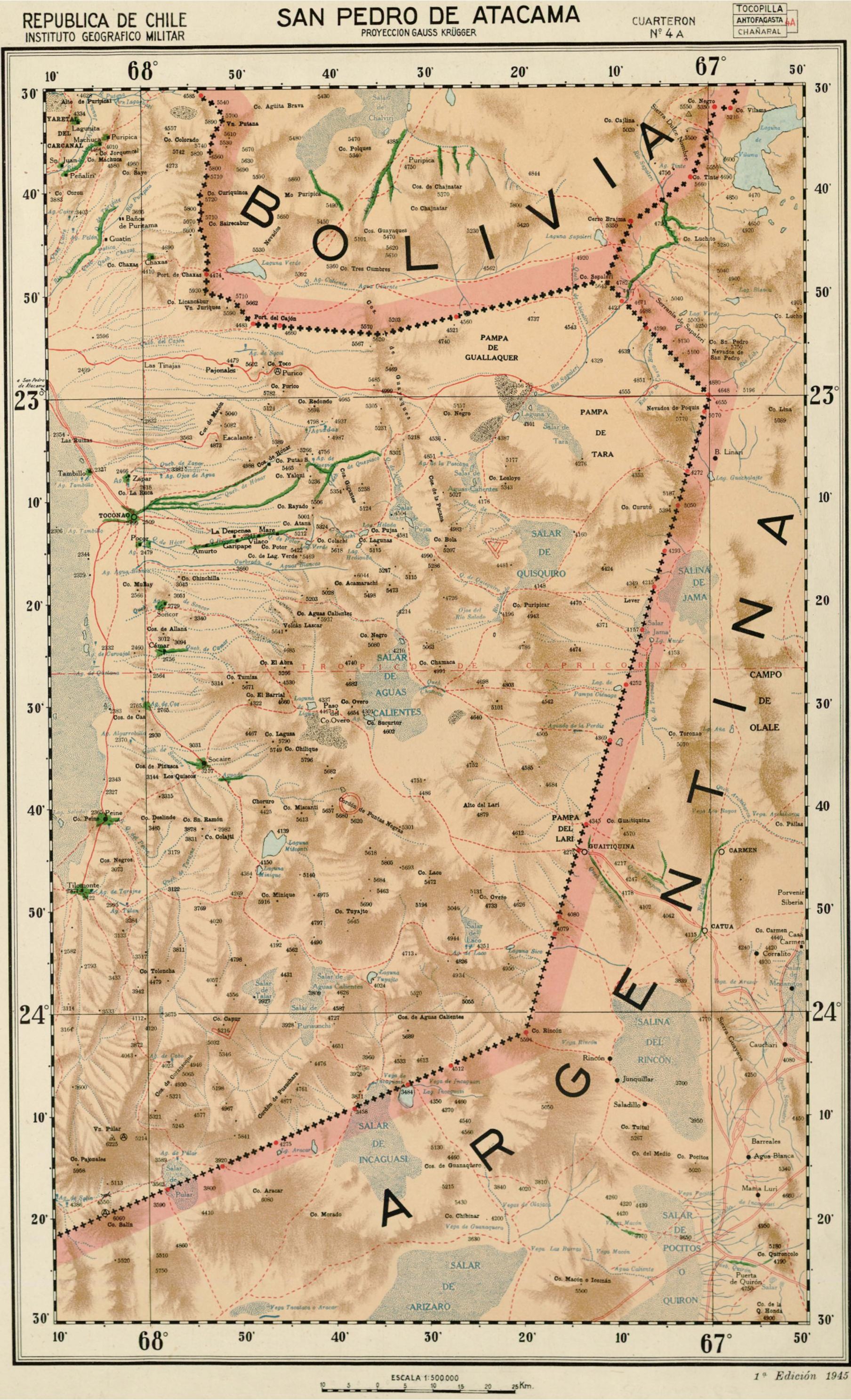
Español: Mapa de la parte chilena de la Puna de Atacama. |
| Date | |
| Source | File:22.30-san-pedro-de-atacama-MP0001050.pdf |
| Author | Instituto Geográfico Militar, Chile. |
Licensing edit
This file has fallen into the public domain according to Chilean copyright law (No. 17336 and its amendments). Nevertheless, its author and source must be acknowledged.
See here for the type of material that is in the public domain (patrimonio cultural común / common cultural heritage).
|

|
File history
Click on a date/time to view the file as it appeared at that time.
| Date/Time | Thumbnail | Dimensions | User | Comment | |
|---|---|---|---|---|---|
| current | 07:34, 22 October 2020 |  | 1,808 × 2,972 (4.89 MB) | Juan Villalobos (talk | contribs) | Uploaded a work by Instituto Geográfico Militar, Chile. from File:22.30-san-pedro-de-atacama-MP0001050.pdf with UploadWizard |
You cannot overwrite this file.
File usage on Commons
There are no pages that use this file.
File usage on other wikis
The following other wikis use this file:
- Usage on es.wikipedia.org