File:38565-Voreppe-Location in paleogeographic map of Isère department.png
Size of this preview: 600 × 600 pixels. Other resolutions: 240 × 240 pixels | 480 × 480 pixels | 768 × 768 pixels | 1,024 × 1,024 pixels | 2,480 × 2,480 pixels.
Original file (2,480 × 2,480 pixels, file size: 527 KB, MIME type: image/png)
Captions
Captions
Add a one-line explanation of what this file represents
Summary
edit
| Description |
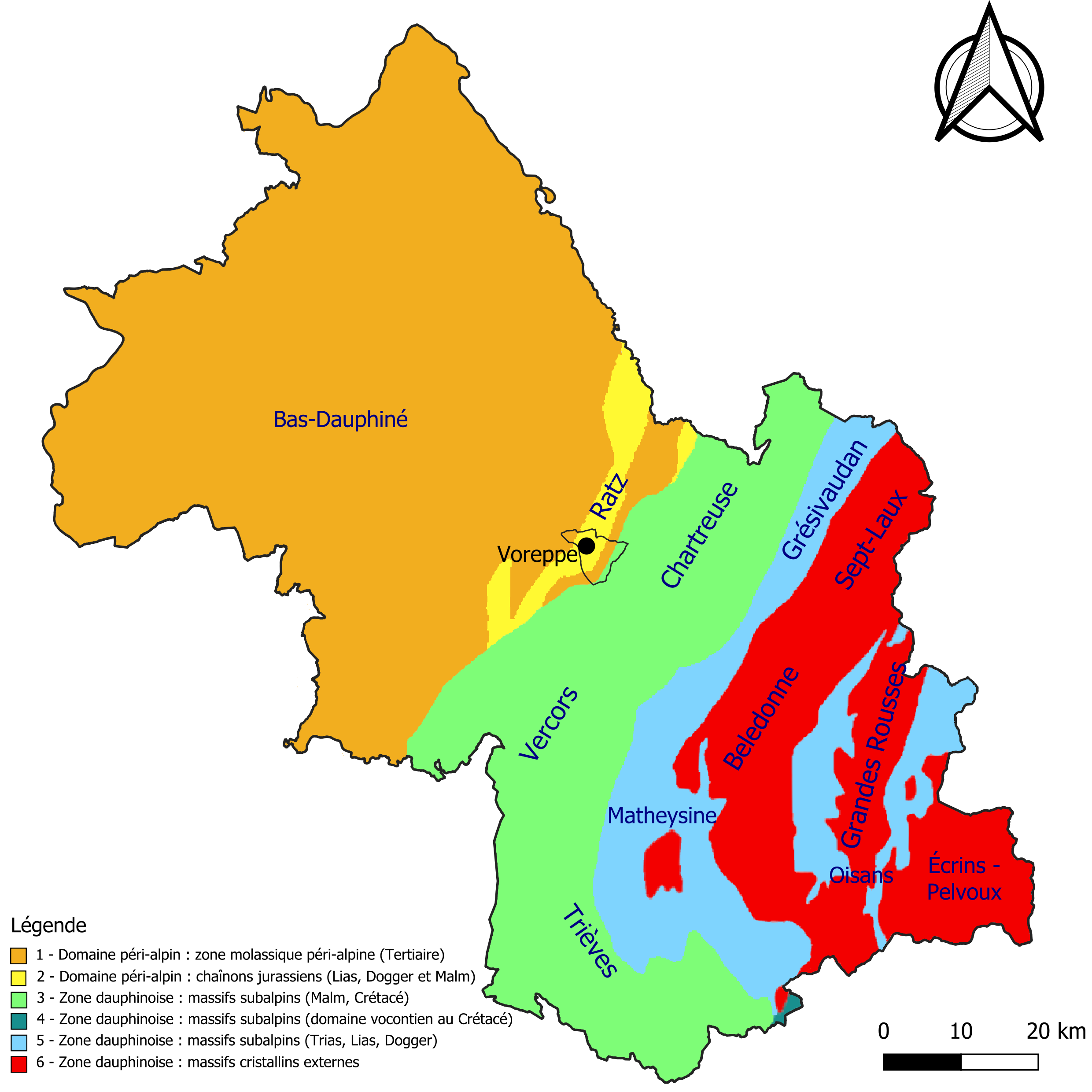
Français : Localisation de la commune de Voreppe dans la carte schématique des zones structurales et des domaines paléogéographiques du département de l'Isère |
| Date | |
| Source |
Own work • Sources des données : Bureau de recherches géologiques et minières (BRGM) : Carte géologique harmonisée du département de l'Isère [1] • Assemblé et enrichi dans QGis. |
| Author | Poudou99 |
Licensing
edit
I, the copyright holder of this work, hereby publish it under the following license:
This file is licensed under the Creative Commons Attribution 4.0 International license.
- You are free:
- to share – to copy, distribute and transmit the work
- to remix – to adapt the work
- Under the following conditions:
- attribution – You must give appropriate credit, provide a link to the license, and indicate if changes were made. You may do so in any reasonable manner, but not in any way that suggests the licensor endorses you or your use.
File history
Click on a date/time to view the file as it appeared at that time.
| Date/Time | Thumbnail | Dimensions | User | Comment | |
|---|---|---|---|---|---|
| current | 00:30, 19 August 2022 | | 2,480 × 2,480 (527 KB) | Poudou99 (talk | contribs) | Uploaded own work with UploadWizard |
You cannot overwrite this file.
File usage on Commons
There are no pages that use this file.
File usage on other wikis
The following other wikis use this file:
- Usage on fr.wikipedia.org