File:A58(M) Slip Road, Leeds - geograph.org.uk - 624818.jpg
No higher resolution available.
A58(M)_Slip_Road,_Leeds_-_geograph.org.uk_-_624818.jpg (640 × 480 pixels, file size: 314 KB, MIME type: image/jpeg)
Captions
Captions
Add a one-line explanation of what this file represents
Summary edit
_Slip_Road,_Leeds_-_geograph.org.uk_-_624818.jpg&action=edit§ion=1)
| Description |
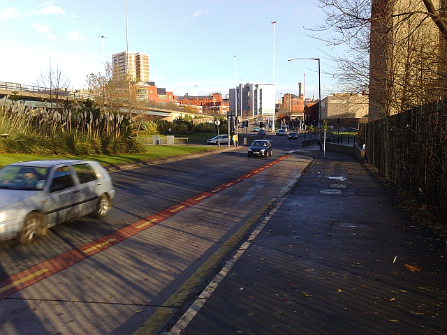
English: A58(M) Slip Road, Leeds. A major Leeds artery this. A couple of years ago, a combination of prolonged heavy rainfall and a blocked drain on this road brought Leeds to a total standstill during evening rush hour (bet that never happened in London!). No one got home on time that day. This is the intersection of the A65 (eventually leading to Kendal) and the A58 (to Halifax). The building partially seen to the right is the Yorkshire (and Evening) Post headquarters. The tall building to the left can also be seen in 608347. |
| Date | |
| Source | From geograph.org.uk |
| Author | Steve Partridge |
| Attribution (required by the license) | Steve Partridge / A58(M) Slip Road, Leeds / |
| Camera location | | View this and other nearby images on: OpenStreetMap |
|---|
_Slip_Road,_Leeds_-_geograph.org.uk_-_624818.jpg¶ms=053.796600_N_-001.560000_E_globe:Earth_type:camera_source:geograph-osgb36(SE290334)_heading:45.00&language=en)
| Object location | | View this and other nearby images on: OpenStreetMap |
|---|
_Slip_Road,_Leeds_-_geograph.org.uk_-_624818.jpg¶ms=053.797400_N_-001.559000_E_globe:Earth_class:object_type:object_source:geograph-osgb36(SE291335)_heading:45.00&language=en)
Licensing edit
_Slip_Road,_Leeds_-_geograph.org.uk_-_624818.jpg&action=edit§ion=2)

|
This image was taken from the Geograph project collection. See this photograph's page on the Geograph website for the photographer's contact details. The copyright on this image is owned by Steve Partridge and is licensed for reuse under the Creative Commons Attribution-ShareAlike 2.0 license.
|
This file is licensed under the Creative Commons Attribution-Share Alike 2.0 Generic license.
Attribution: Steve Partridge
- You are free:
- to share – to copy, distribute and transmit the work
- to remix – to adapt the work
- Under the following conditions:
- attribution – You must give appropriate credit, provide a link to the license, and indicate if changes were made. You may do so in any reasonable manner, but not in any way that suggests the licensor endorses you or your use.
- share alike – If you remix, transform, or build upon the material, you must distribute your contributions under the same or compatible license as the original.
File history
Click on a date/time to view the file as it appeared at that time.
| Date/Time | Thumbnail | Dimensions | User | Comment | |
|---|---|---|---|---|---|
| current | 05:07, 7 February 2011 | | 640 × 480 (314 KB) | GeographBot (talk | contribs) | == {{int:filedesc}} == {{Information |description={{en|1=A58(M) Slip Road, Leeds A major Leeds artery this. A couple of years ago, a combination of prolonged heavy rainfall and a blocked drain on this road brought Leeds to a total standstill during eveni |
You cannot overwrite this file.
File usage on Commons
There are no pages that use this file.
_Slip_Road,_Leeds_-_geograph.org.uk_-_624818.jpg&oldid=773361426)