File:ALMAs OSF An Oasis in the Desert.jpg
Size of this preview: 800 × 529 pixels. Other resolutions: 320 × 212 pixels | 640 × 423 pixels | 1,024 × 677 pixels | 1,280 × 846 pixels | 2,560 × 1,692 pixels | 4,538 × 3,000 pixels.
Original file (4,538 × 3,000 pixels, file size: 3.34 MB, MIME type: image/jpeg)
Captions
Captions
Add a one-line explanation of what this file represents
Summary edit
| Description |
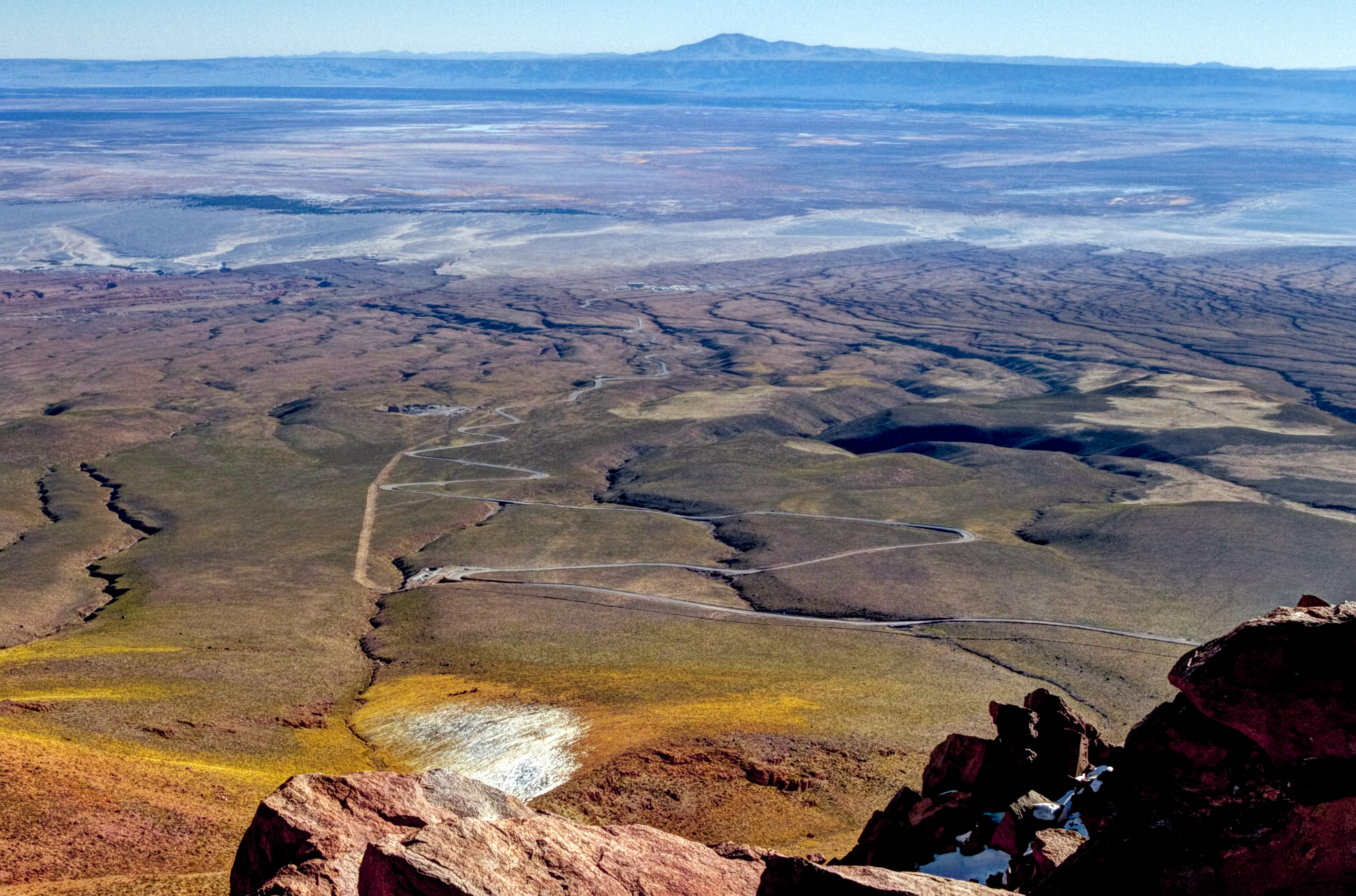
English: At the end of the long, winding road in this image is the Atacama Large Millimeter/submillimeter Array (ALMA)’s Operational Support Facility (OSF). The OSF serves as a base camp for contractors and staff working at ALMA and its facilities are the centre of all scientific activities related to ALMA’s daily operation. Beyond the ALMA camp the white salt flat known as El Salar de Atacama is visible, the largest salt flat in Chile. Towards the horizon is the mountain known as Cerro Quimal. This photograph was taken from 4660 metres above sea level by photographer José Velásquez during a Sunday trek from Cerro de Macón towards the Array Operations Site (AOS). ALMA is the largest astronomical project in existence and is a truly global partnership between Europe, North America and East Asia, in cooperation with the Republic of Chile. Last year, ALMA was inaugurated at an official ceremony, which marked the completion of all the major systems of the array and the formal transition from a construction project to a fully-fledged observatory. Links This photo on Flickr Your ESO Pictures on Flickr José Velásquez’s Flickr stream |
||||
| Date | |||||
| Source | http://www.eso.org/public/images/potw1515a/ | ||||
| Author | J. Velásquez/ESO | ||||
| Permission (Reusing this file) |
|
||||
| Camera location | | View this and other nearby images on: OpenStreetMap |
|---|
| Annotations | This image is annotated: View the annotations at Commons |
.jpg)

File history
Click on a date/time to view the file as it appeared at that time.
| Date/Time | Thumbnail | Dimensions | User | Comment | |
|---|---|---|---|---|---|
| current | 10:49, 14 February 2024 | | 4,538 × 3,000 (3.34 MB) | C messier (talk | contribs) | full size |
| 00:46, 14 April 2015 |  | 1,280 × 846 (324 KB) | Jmencisom (talk | contribs) | User created page with UploadWizard |
You cannot overwrite this file.
File usage on Commons
The following page uses this file:
- File:ALMA’s OSF An Oasis in the Desert (17138646442).jpg (file redirect)
.jpg&redirect=no)
File usage on other wikis
The following other wikis use this file:
- Usage on ca.wikipedia.org
- Usage on en.wikipedia.org
- Usage on es.wikipedia.org
- Usage on nl.wikipedia.org