File:AMH-4723-NA View of the island of Neira.jpg

Size of this preview: 800 × 575 pixels. Other resolutions: 320 × 230 pixels | 640 × 460 pixels | 1,024 × 736 pixels | 1,280 × 921 pixels | 2,400 × 1,726 pixels.
Original file (2,400 × 1,726 pixels, file size: 527 KB, MIME type: image/jpeg)
Captions
Captions
Add a one-line explanation of what this file represents
Summary edit
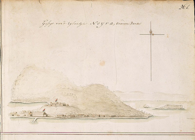
Nederlands: Gezicht op het eiland Neira
English: View of the island of Neira( |
||||||||||||||||||||||||||
|---|---|---|---|---|---|---|---|---|---|---|---|---|---|---|---|---|---|---|---|---|---|---|---|---|---|---|
| Author |
Nederlands: Isaac de Graaff (landmeter / kaartenmaker)
English: Isaac de Graaff (land surveyor / mapmaker) |
|||||||||||||||||||||||||
| Title |
Nederlands: Gezicht op het eiland Neira
English: View of the island of Neira |
|||||||||||||||||||||||||
| Description |
Nederlands: Titel catalogus Leupe (NA): Gesigt van 't Eilandjie Neira, benoorden Banda.
Rechts boven genummerd: 26.b.
English: According to the Leupe catalogue (NA), the original title reads: Gesigt van 't Eilandjie Neira, benoorden Banda.
Numbered top right: 26.b. |
|||||||||||||||||||||||||
| Date | between 1690 and 1705 | |||||||||||||||||||||||||
| Medium |
Nederlands: ingekleurde tekening op papier
English: coloured drawing on paper |
|||||||||||||||||||||||||
| Dimensions | height: 37.5 cm (14.7 in); width: 53 cm (20.8 in) | |||||||||||||||||||||||||
| Collection |
|
|||||||||||||||||||||||||
| Accession number |
NL-HaNA_4.VEL_1360 (old number: VEL1360) |
|||||||||||||||||||||||||
| Inscriptions |
Gesigt van 't Eilandjie Neira, benoorden Banda
|
|||||||||||||||||||||||||
| Notes |
English: Subjects: fortification, compass / dial, survey / view, anchorage / pier / harbour, building
Nederlands: Onderwerpen: vesting, kompas / windroos, overzicht / aanzicht, rede / haven / pier, gebouw
English: Fort: this image is related to a VOC fort called fort Belgica |
|||||||||||||||||||||||||
| Source/Photographer |
|
|||||||||||||||||||||||||
| Permission (Reusing this file) |
|
|||||||||||||||||||||||||

| Object location | | View this and other nearby images on: OpenStreetMap |
|---|
File history
Click on a date/time to view the file as it appeared at that time.
| Date/Time | Thumbnail | Dimensions | User | Comment | |
|---|---|---|---|---|---|
| current | 17:08, 10 June 2014 | | 2,400 × 1,726 (527 KB) | HuskyBot (talk | contribs) | == {{int:filedesc}} == {{Artwork |title = {{nl|1=Gezicht op het eiland Neira}} {{en|1=View of the island of Neira}} |description = {{nl|1=Titel catalogus Leupe (NA): ''Gesigt van 't Eilandjie Neira, benoorden B... |
You cannot overwrite this file.
File usage on Commons
The following page uses this file: