File:AMH-5359-NA Map of Ceylon.jpg

Size of this preview: 800 × 575 pixels. Other resolutions: 320 × 230 pixels | 640 × 460 pixels | 1,024 × 736 pixels | 1,280 × 920 pixels | 2,400 × 1,725 pixels.
Original file (2,400 × 1,725 pixels, file size: 576 KB, MIME type: image/jpeg)
Captions
Captions
Add a one-line explanation of what this file represents
Summary
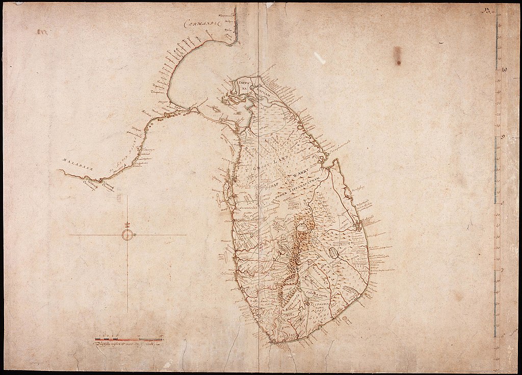
editNederlands: Kaart van Ceylon
English: Map of Ceylon( |
||||||||||||||||||||||||||
|---|---|---|---|---|---|---|---|---|---|---|---|---|---|---|---|---|---|---|---|---|---|---|---|---|---|---|
| Author |
Nederlands: Isaac de Graaff (landmeter / kaartenmaker)
English: Isaac de Graaff (land surveyor / mapmaker) |
|||||||||||||||||||||||||
| Title |
Nederlands: Kaart van Ceylon
English: Map of Ceylon |
|||||||||||||||||||||||||
| Description |
Nederlands: Titel catalogus Leupe (NA): Kaart van het Eiland Ceylon, een klein gedeelte van de Kust van Malabar, Madure en Cormandel.
Rechtsboven genummerd: 23.a. De kaart is op linnen geplakt.English: Title in the Leupe catalogue (National Archives): Kaart van het Eiland Ceylon, een klein gedeelte van de Kust van Malabar, Madure en Cormandel.
Numbered top right: 23.a. The map has been pasted on linen. |
|||||||||||||||||||||||||
| Date | between 1690 and 1743 | |||||||||||||||||||||||||
| Medium |
Nederlands: pen op papier
English: pen on paper |
|||||||||||||||||||||||||
| Dimensions | height: 72 cm (28.3 in); width: 51.5 cm (20.2 in) | |||||||||||||||||||||||||
| Collection |
|
|||||||||||||||||||||||||
| Accession number |
NL-HaNA_4.VEL_924 (old number: VEL0924) |
|||||||||||||||||||||||||
| Inscriptions |
-
|
|||||||||||||||||||||||||
| Notes |
English: Subjects: chart / map / plan
Nederlands: Onderwerpen: plattegrond / kaart
English: Post: this image is related to a VOC trading post called Colombo |
|||||||||||||||||||||||||
| Source/Photographer |
|
|||||||||||||||||||||||||
| Permission (Reusing this file) |
|
|||||||||||||||||||||||||

| Object location | | View this and other nearby images on: OpenStreetMap |
|---|
File history
Click on a date/time to view the file as it appeared at that time.
| Date/Time | Thumbnail | Dimensions | User | Comment | |
|---|---|---|---|---|---|
| current | 18:06, 10 June 2014 | | 2,400 × 1,725 (576 KB) | HuskyBot (talk | contribs) | == {{int:filedesc}} == {{Artwork |title = {{nl|1=Kaart van Ceylon}} {{en|1=Map of Ceylon}} |description = {{nl|1=Titel catalogus Leupe (NA): ''Kaart van het Eiland Ceylon, een klein gedeelte van de Kust van Mal... |
You cannot overwrite this file.
File usage on Commons
The following page uses this file:
File usage on other wikis
The following other wikis use this file:
- Usage on nl.wikipedia.org