File:AMH-6415-NA Map of Zeelandia on Formosa.jpg
Size of this preview: 800 × 547 pixels. Other resolutions: 320 × 219 pixels | 640 × 438 pixels | 1,024 × 701 pixels | 1,280 × 876 pixels | 2,400 × 1,642 pixels.
Original file (2,400 × 1,642 pixels, file size: 654 KB, MIME type: image/jpeg)
Captions
Captions
Add a one-line explanation of what this file represents
Summary edit
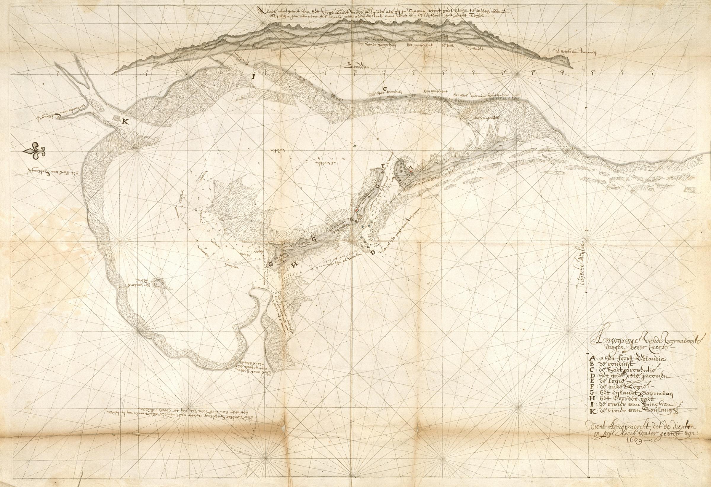
Nederlands: Kaart van Zeelandia, Formosa
English: Map of Zeelandia on Formosa( |
||||||||||||||||||||||||
|---|---|---|---|---|---|---|---|---|---|---|---|---|---|---|---|---|---|---|---|---|---|---|---|---|
| Author |
Nederlands: Anoniem / Anonymous (landmeter / kaartenmaker)
English: Anoniem / Anonymous (land surveyor / mapmaker) |
|||||||||||||||||||||||
| Title |
Nederlands: Kaart van Zeelandia, Formosa
English: Map of Zeelandia on Formosa |
|||||||||||||||||||||||
| Description |
Nederlands: Titel in catalogus Leupe (Nationaal Archief): "Caerte van Teyouan". Kustkaart met loodingen van 1629.
Notities verso: caerte van Teijouhan / No. 32 [volgnummer van het stuk in de band ?] / uit overgekomen br. en papieren 1630 QQII / 229 [folionummer in de band].
English: Title in the Leupe Catalogue (National Archives):"Caerte van Teyouan". Kustkaart met loodingen van 1629.
Notes on reverse: caerte van Teijouhan / No. 32 [serial number of the item in the volume ?] / uit overgekomen br. en papieren 1630 QQII / 229 [folio number in the volume]. |
|||||||||||||||||||||||
| Date | 1629 | |||||||||||||||||||||||
| Medium |
Nederlands: pen en penseel op papier
English: pen and brush on paper |
|||||||||||||||||||||||
| Dimensions | height: 77 cm (30.3 in); width: 53.5 cm (21 in) | |||||||||||||||||||||||
| Collection |
|
|||||||||||||||||||||||
| Accession number |
NL-HaNA_4.VELH_140 (old number: VELH0140) |
|||||||||||||||||||||||
| Notes |
English: Subjects: chart / map / plan, key
Nederlands: Onderwerpen: plattegrond / kaart, legenda |
|||||||||||||||||||||||
| Source/Photographer |
|
|||||||||||||||||||||||
| Permission (Reusing this file) |
|
|||||||||||||||||||||||

| Object location | | View this and other nearby images on: OpenStreetMap |
|---|
File history
Click on a date/time to view the file as it appeared at that time.
| Date/Time | Thumbnail | Dimensions | User | Comment | |
|---|---|---|---|---|---|
| current | 09:21, 11 June 2014 | | 2,400 × 1,642 (654 KB) | HuskyBot (talk | contribs) | == {{int:filedesc}} == {{Artwork |title = {{nl|1=Kaart van Zeelandia, Formosa}} {{en|1=Map of Zeelandia on Formosa}} |description = {{nl|1=Titel in catalogus Leupe (Nationaal Archief): ''"Caerte van Teyouan". K... |
You cannot overwrite this file.
File usage on Commons
The following page uses this file: