File:AMS Trivandrum (cropped) now Thiruvananthapuram costal region.jpg

Size of this preview: 450 × 600 pixels. Other resolutions: 180 × 240 pixels | 360 × 480 pixels | 862 × 1,149 pixels.
Original file (862 × 1,149 pixels, file size: 305 KB, MIME type: image/jpeg)
Captions
Captions
Add a one-line explanation of what this file represents
Summary edit
| Description |
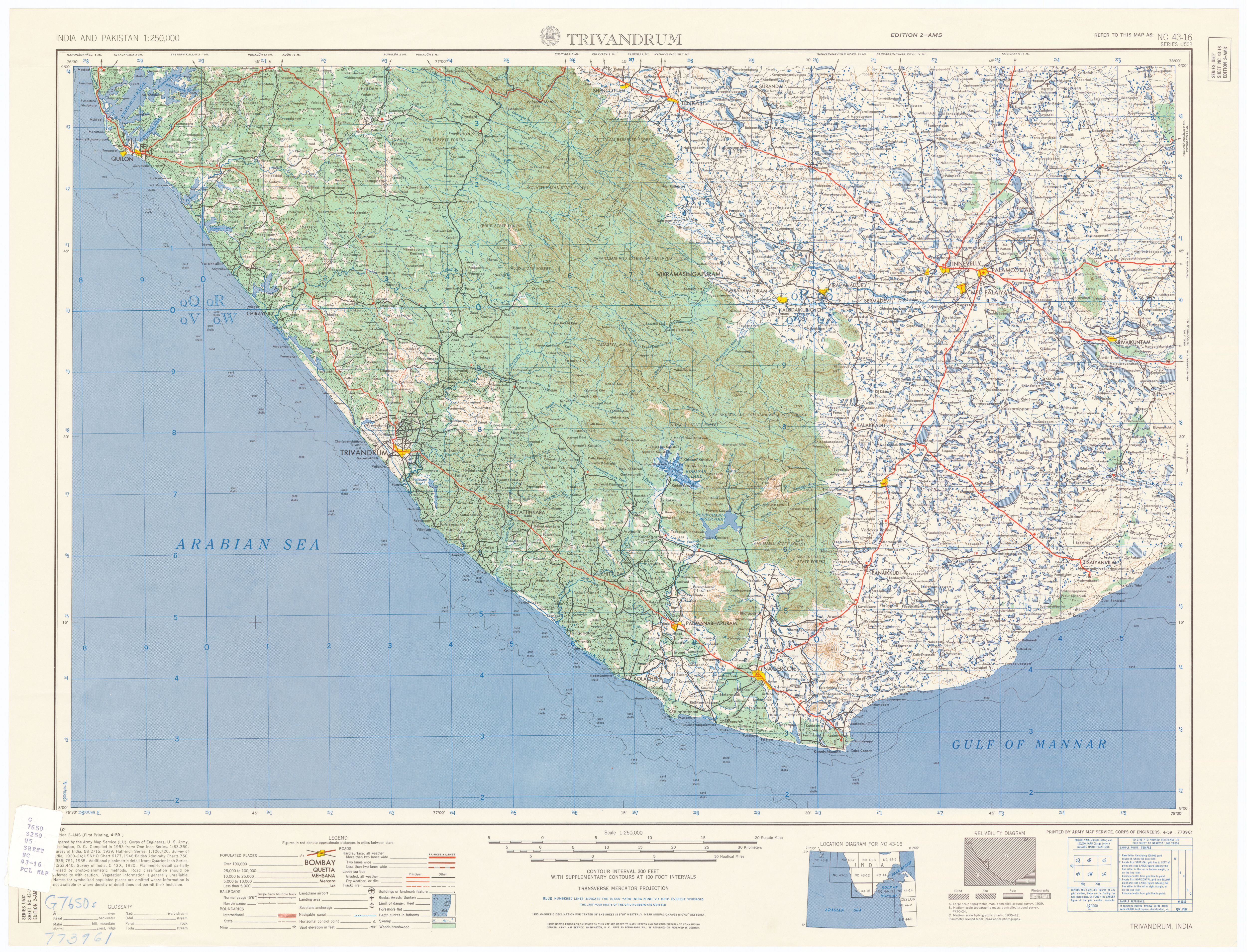
Topographic map of Trivandrum (now Thiruvananthapuram), Kerala, India area, with Poovar (Puvar) |
|||||||||
| Date | ||||||||||
| Source | http://www.lib.utexas.edu/maps/ams/india/nc-43-16a.jpg | |||||||||
| Creator |
U.S. Army Map Service |
|||||||||
| Permission (Reusing this file) |
US Govt work | |||||||||
| Geotemporal data | ||||||||||
| Bounding box |
|
|||||||||
| Georeferencing | ||||||||||
| Other versions | http://www.lib.utexas.edu/maps/ams/india/ | |||||||||

_now_Thiruvananthapuram_costal_region.jpg&action=edit§ion=1)
Licensing edit
_now_Thiruvananthapuram_costal_region.jpg&action=edit§ion=2)
This work is in the public domain in the United States because it is a work prepared by an officer or employee of the United States Government as part of that person’s official duties under the terms of Title 17, Chapter 1, Section 105 of the US Code.
Note: This only applies to original works of the Federal Government and not to the work of any individual U.S. state, territory, commonwealth, county, municipality, or any other subdivision. This template also does not apply to postage stamp designs published by the United States Postal Service since 1978. (See § 313.6(C)(1) of Compendium of U.S. Copyright Office Practices). It also does not apply to certain US coins; see The US Mint Terms of Use.
|
 | |
| This file has been identified as being free of known restrictions under copyright law, including all related and neighboring rights. | ||
File history
Click on a date/time to view the file as it appeared at that time.
| Date/Time | Thumbnail | Dimensions | User | Comment | |
|---|---|---|---|---|---|
| current | 14:28, 1 January 2019 | | 862 × 1,149 (305 KB) | Maimaid (talk | contribs) | File:AMS Trivandrum.jpg cropped 83 % horizontally, 70 % vertically using CropTool with precise mode. |
You cannot overwrite this file.
File usage on Commons
The following page uses this file:
_now_Thiruvananthapuram_costal_region.jpg&oldid=775683216)