File:A Geostationary Operational Environmental Satellite-13 infrared satellite image of Tropical Storm Isaac provided by the U.S. Naval Research Laboratory in Monterey, Calif., shows the storm at 7 p.m. EST Aug. 27 120827-N-ZZ999-101.jpg
Size of this preview: 691 × 600 pixels. Other resolutions: 277 × 240 pixels | 553 × 480 pixels | 885 × 768 pixels | 1,024 × 889 pixels.
Original file (1,024 × 889 pixels, file size: 678 KB, MIME type: image/jpeg)
Captions
Captions
Add a one-line explanation of what this file represents
Summary edit
| Description |
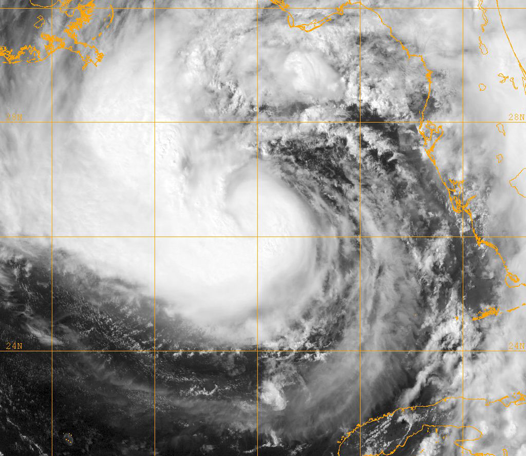
English: A Geostationary Operational Environmental Satellite-13 infrared satellite image of Tropical Storm Isaac provided by the U.S. Naval Research Laboratory in Monterey, Calif., shows the storm at 7 p.m. EST Aug. 27, 2012. Isaac was expected to strengthen into a hurricane and impact the Gulf Coast of the United States Aug. 28 or 29. Isaac developed as a tropical storm over the Western Atlantic Ocean Aug. 21, 2012, affecting Puerto Rico, the Dominican Republic, Haiti and Cuba before making landfall as a hurricane on the Gulf Coast of the United States. |
|||
| Date | Taken on 27 August 2012 | |||
| Source | http://www.defenseimagery.mil/imageRetrieve.action?guid=458d7bf5c0e6b631f32965dc9d69ad416532aa8d&t=2 | |||
| Author | U.S. Navy | |||
| Permission (Reusing this file) |
Public domain photograph from defenseimagery.mil. | |||
| Location | Unknown location | |||
| VIRIN |
|
|||
| Gallery page | http://www.defenseimagery.mil/imagery.html?&guid=458d7bf5c0e6b631f32965dc9d69ad416532aa8d | |||
| Posted | 28 August 2012 |

Licensing edit
This image is a work of a U.S. military or Department of Defense employee, taken or made as part of that person's official duties. As a work of the U.S. federal government, the image is in the public domain in the United States.
|
 |
File history
Click on a date/time to view the file as it appeared at that time.
| Date/Time | Thumbnail | Dimensions | User | Comment | |
|---|---|---|---|---|---|
| current | 19:54, 28 August 2013 | | 1,024 × 889 (678 KB) | Fæ (talk | contribs) | == {{int:filedesc}} == {{milim | description = {{en|A Geostationary Operational Environmental Satellite-13 infrared satellite image of Tropical Storm Isaac provided by the U.S. Naval Research Laboratory in Monterey, Calif., shows the storm at 7 p.m. ES... |
You cannot overwrite this file.
File usage on Commons
There are no pages that use this file.