File:A Map of the Inhabited Part of Canada. Frontispiece by William Faden 1777.jpg
Size of this preview: 800 × 571 pixels. Other resolutions: 320 × 228 pixels | 640 × 457 pixels | 1,024 × 731 pixels | 1,280 × 914 pixels | 1,506 × 1,075 pixels.
Original file (1,506 × 1,075 pixels, file size: 1.18 MB, MIME type: image/jpeg)
Captions
Captions
Add a one-line explanation of what this file represents
Summary edit
| Description |
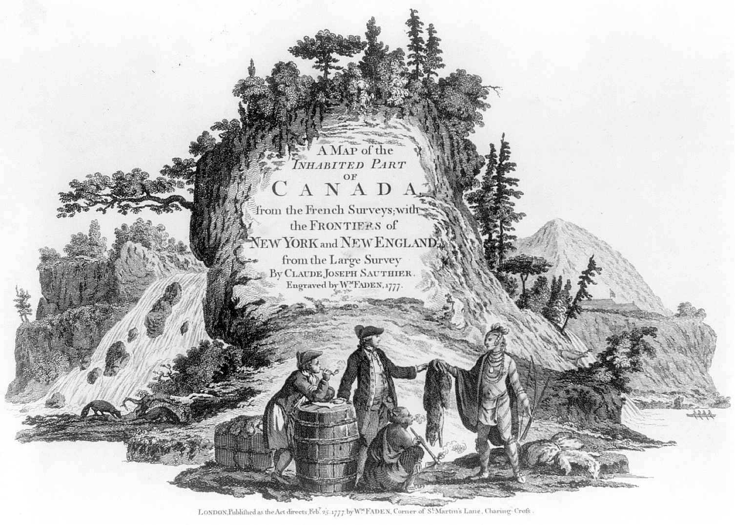
English: "A Map of the Inhabited Part of Canada from the French Surveys; with the Frontiers of New York and New England from the Large Survey by Claude Joseph Sauthier. Engraved by Wm. Faden, 1777. London. Published as the Act directs by Wm. Faden, Corner of St. Martin's Lane, Charing-Cross, 1777 Feby. 25." Cartouche showing English fur traders dealing with Indians in Canada. |
||||||||||||||||||||||
| Date | 1777.02.25 (publication date) | ||||||||||||||||||||||
| Source |
|
||||||||||||||||||||||
| Author |
|
||||||||||||||||||||||
| Permission (Reusing this file) |
PD-US "No known restrictions on publication." | ||||||||||||||||||||||

Licensing edit
This media file is in the public domain in the United States. This applies to U.S. works where the copyright has expired, often because its first publication occurred prior to January 1, 1929, and if not then due to lack of notice or renewal. See this page for further explanation.
|
 | |
 |
This image might not be in the public domain outside of the United States; this especially applies in the countries and areas that do not apply the rule of the shorter term for US works, such as Canada, Mainland China (not Hong Kong or Macao), Germany, Mexico, and Switzerland. The creator and year of publication are essential information and must be provided. See Wikipedia:Public domain and Wikipedia:Copyrights for more details.
|
File history
Click on a date/time to view the file as it appeared at that time.
| Date/Time | Thumbnail | Dimensions | User | Comment | |
|---|---|---|---|---|---|
| current | 11:58, 9 May 2009 | | 1,506 × 1,075 (1.18 MB) | Mu (talk | contribs) | {{Information |Description={{en|1="A Map of the Inhabited Part of Canada from the French Surveys; with the Frontiers of New York and New England from the Large Survey by Claude Joseph Sauthier. Engraved by Wm. Faden, 1777. London. Published as the Act dir |
You cannot overwrite this file.
File usage on Commons
There are no pages that use this file.
File usage on other wikis
The following other wikis use this file:
- Usage on de.wikipedia.org