File:A New Map of the Eastern Parts of Asia Minor.jpg
Size of this preview: 787 × 600 pixels. Other resolutions: 315 × 240 pixels | 630 × 480 pixels | 1,008 × 768 pixels | 1,280 × 975 pixels | 2,560 × 1,951 pixels | 3,500 × 2,667 pixels.
Original file (3,500 × 2,667 pixels, file size: 3.02 MB, MIME type: image/jpeg)
Captions
Captions
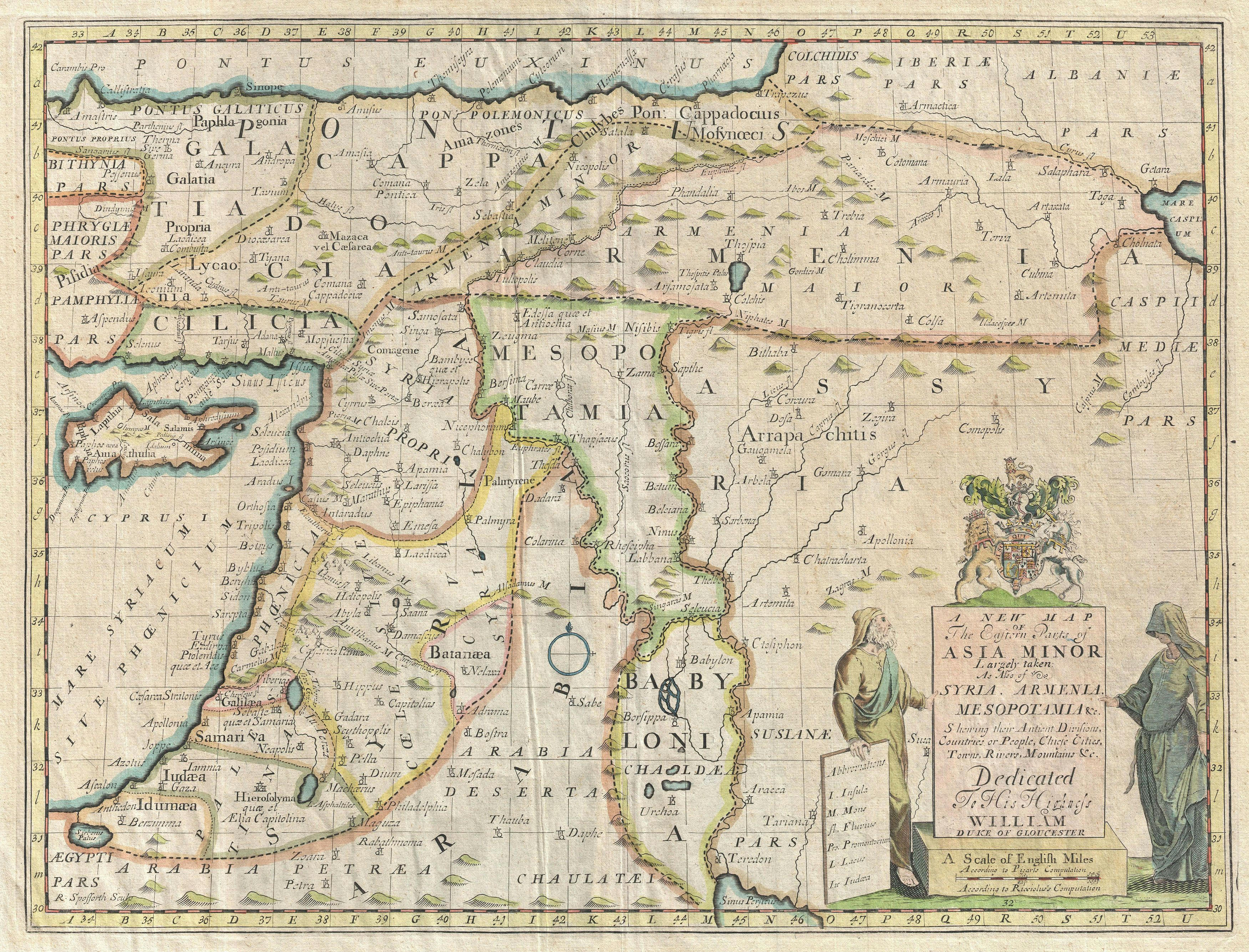
A New Map of the Eastern Parts of Asia Minor Largely taken: As Also of Syria, Armenia, Mesopotamia and c. Showing their Antient Divisions, Countries or People, Chiefe Cities, Towns, Rivers, Mountains,
Summary edit
| Description |
English: A New Map of the Eastern Parts of Asia Minor Largely taken: As Also of Syria, Armenia, Mesopotamia and c. Showing their Antient Divisions, Countries or People, Chiefe Cities, Towns, Rivers, Mountains, and c. Dedicated to His Highness William Duke of Gloucester. |
| Date | circa 1712 |
| Source | https://www.geographicus.com/P/AntiqueMap/AsiaMinor-wells-1712 |
| Author | Edward Wells |
| Other versions |

Licensing edit
|
This work is in the public domain in its country of origin and other countries and areas where the copyright term is the author's life plus 70 years or fewer. This work is in the public domain in the United States because it was published (or registered with the U.S. Copyright Office) before January 1, 1929. | |
| This file has been identified as being free of known restrictions under copyright law, including all related and neighboring rights. | |
File history
Click on a date/time to view the file as it appeared at that time.
| Date/Time | Thumbnail | Dimensions | User | Comment | |
|---|---|---|---|---|---|
| current | 13:43, 7 August 2020 | | 3,500 × 2,667 (3.02 MB) | Balkanique (talk | contribs) | Uploaded a work by Edward Wells from https://www.geographicus.com/P/AntiqueMap/AsiaMinor-wells-1712 with UploadWizard |
You cannot overwrite this file.
File usage on Commons
The following page uses this file: