File:A map from NOAA showing an EF2 tornado striking Taylorville, Illinois on August 6, 2023.jpg

Size of this preview: 800 × 569 pixels. Other resolutions: 320 × 227 pixels | 640 × 455 pixels | 1,024 × 728 pixels | 1,280 × 910 pixels | 1,614 × 1,147 pixels.
Original file (1,614 × 1,147 pixels, file size: 860 KB, MIME type: image/jpeg)
Captions
Captions
Add a one-line explanation of what this file represents
Summary edit
| Description |
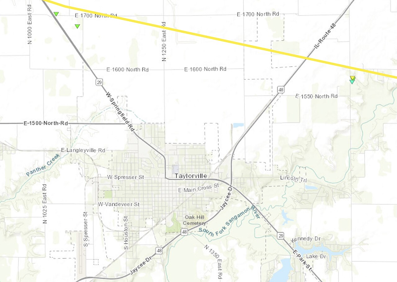
English: A map from the National Oceanic and Atmospheric Administration (NOAA) showing a the track of a tornado, which was rated EF2 on the Enhanced Fujita scale, crossing through the northern portion of Taylorville, Illinois. The city limits of Taylorville is highlighted by a dashed line. |
| Date | |
| Source | NOAA’s Damage Assessment Toolkit: https://apps.dat.noaa.gov/stormdamage/damageviewer/ |
| Author | National Oceanic and Atmospheric Administration |
Licensing edit
This image is in the public domain because it contains materials that originally came from the U.S. National Oceanic and Atmospheric Administration, taken or made as part of an employee's official duties.
|
File history
Click on a date/time to view the file as it appeared at that time.
| Date/Time | Thumbnail | Dimensions | User | Comment | |
|---|---|---|---|---|---|
| current | 04:49, 8 August 2023 | | 1,614 × 1,147 (860 KB) | WeatherWriter (talk | contribs) | Uploaded a work by National Oceanic and Atmospheric Administration from NOAA’s Damage Assessment Toolkit: https://apps.dat.noaa.gov/stormdamage/damageviewer/ with UploadWizard |
You cannot overwrite this file.
File usage on Commons
There are no pages that use this file.