File:Aaron-Greenstein mausoleum, Forest Lawn Cemetery, Buffalo, New York - 20221129.jpg

Size of this preview: 800 × 600 pixels. Other resolutions: 320 × 240 pixels | 640 × 480 pixels | 1,024 × 768 pixels | 1,280 × 960 pixels | 2,560 × 1,920 pixels | 3,456 × 2,592 pixels.
Original file (3,456 × 2,592 pixels, file size: 5.99 MB, MIME type: image/jpeg)
Captions
Captions
Add a one-line explanation of what this file represents
Summary edit
| Description |
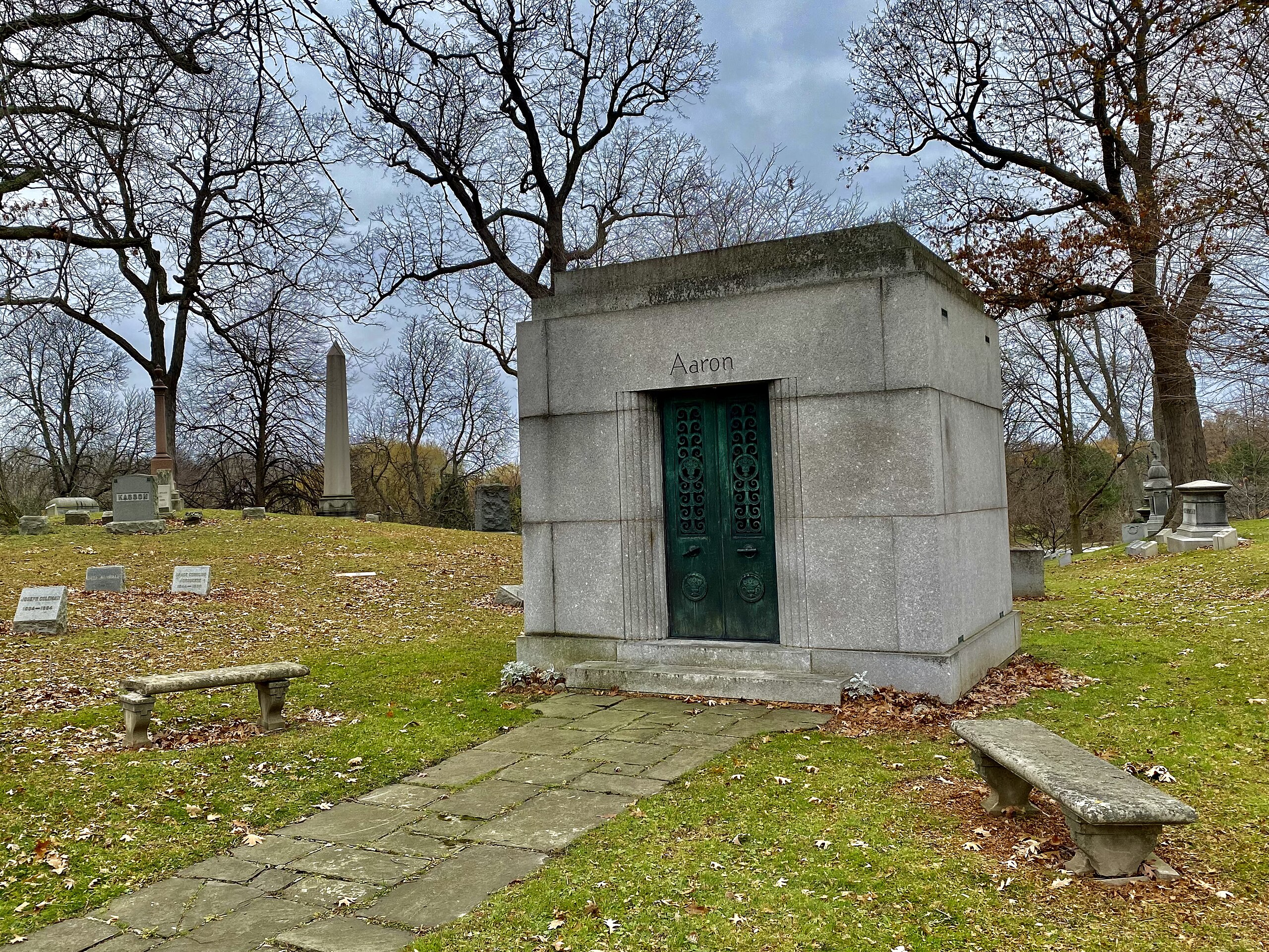
English: The Aaron-Greenstein Mausoleum at Forest Lawn Cemetery in Buffalo, New York, as seen on a November 2022 afternoon. Available sources for the date of the mausoleum's design and construction are lacking, but given its Art Deco styling - note the ornamentation on the grillework of the bronze entrance, the curved reeded corners flanking it, and the stepbacks atop the flat roof - a good estimate would be between the late 1920s and early '40s. The architect is also one of the three people laid to rest inside of it: Louis Greenstein (1886-1972), a Buffalo native who as a young draftsman cut his teeth with the local practices of McCreary, Wood & Bradney, Green & Wicks, and Edgar Joralemon before attending Columbia University and then setting up his own practice. Aside from his architectural legacy, which prominently includes designs for many area synagogues in reflection of his Jewish faith and was capped off by a term as president of the local chapter of the American Institute of Architects, Greenstein is also notable as designer of Buffalo's city flag and Erie County's official seal. Greenstein was preceded in death by his wife Shinah née Aaron (1886-1967) and followed closely by his brother-in-law Dr. Abraham H. Aaron (1879-1975), who was notable in his own right as an internationally-renowned gastroenterologist who served as an attending physician at Buffalo General Hospital, professor at the University at Buffalo Medical School, former president of the Erie County Medical Society and Buffalo Academy of Medicine, former vice-president and committee chairman of the New York State Medical Society, and former Chief Examiner of the National Board of Medical Examiners, among myriad other positions and honors. |
| Date | |
| Source | Own work |
| Author | Andre Carrotflower |
| Camera location | | View this and other nearby images on: OpenStreetMap |
|---|
Licensing edit
I, the copyright holder of this work, hereby publish it under the following license:
This file is licensed under the Creative Commons Attribution-Share Alike 4.0 International license.
- You are free:
- to share – to copy, distribute and transmit the work
- to remix – to adapt the work
- Under the following conditions:
- attribution – You must give appropriate credit, provide a link to the license, and indicate if changes were made. You may do so in any reasonable manner, but not in any way that suggests the licensor endorses you or your use.
- share alike – If you remix, transform, or build upon the material, you must distribute your contributions under the same or compatible license as the original.
File history
Click on a date/time to view the file as it appeared at that time.
| Date/Time | Thumbnail | Dimensions | User | Comment | |
|---|---|---|---|---|---|
| current | 01:13, 8 December 2022 | | 3,456 × 2,592 (5.99 MB) | Andre Carrotflower (talk | contribs) | Uploaded own work with UploadWizard |
You cannot overwrite this file.
File usage on Commons
There are no pages that use this file.