File:Abies lasiocarpa 8566.JPG
Size of this preview: 400 × 600 pixels. Other resolutions: 160 × 240 pixels | 320 × 480 pixels | 512 × 768 pixels | 682 × 1,024 pixels | 1,365 × 2,048 pixels | 2,848 × 4,272 pixels.
Original file (2,848 × 4,272 pixels, file size: 7.51 MB, MIME type: image/jpeg)
Captions
Captions
Add a one-line explanation of what this file represents
Summary edit
| Description |
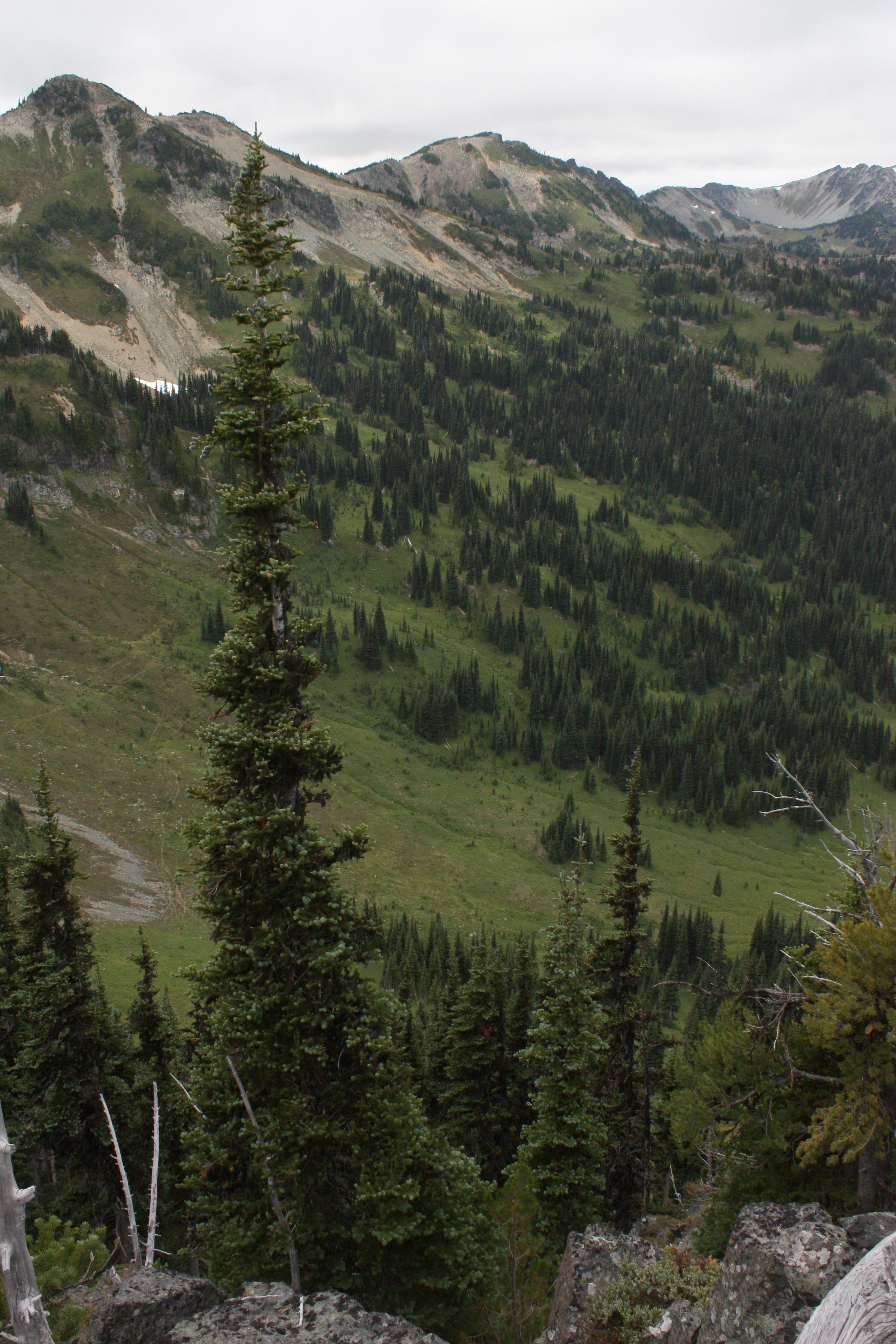
Abies lasiocarpa English: Subalpine Fir, Alpine Fir, Balsam or White Balsam Fir; Antler Peak (7017 feet, center) |
| Date | 27 August 2010, 19:31:15 +00:00 |
| Source | Own work |
| Author | Walter Siegmund (talk) |
| Other versions |
|

| Camera location | | View this and other nearby images on: OpenStreetMap |
|---|
- Location source: Google Earth, Casio 1675 altimeter watch
- Location Datum: WGS84
- Viewpoint location: Sourdough Mountains crest, Mount Rainier National Park
- Viewpoint elevation: 2005 meter (6578 ft)
- View direction: West-southwest
- Camera: Canon EOS DIGITAL REBEL XSi
- Exposure Time: 1/320
- F Number: f/11.0
- Focal Length: 20.0
- ISO Speed Rating: 400
©2010 Walter Siegmund
Licensing edit
I, the copyright holder of this work, hereby publish it under the following licenses:

|
Permission is granted to copy, distribute and/or modify this document under the terms of the GNU Free Documentation License, Version 1.2 or any later version published by the Free Software Foundation; with no Invariant Sections, no Front-Cover Texts, and no Back-Cover Texts. A copy of the license is included in the section entitled GNU Free Documentation License. |
This file is licensed under the Creative Commons Attribution-Share Alike 3.0 Unported, 2.5 Generic, 2.0 Generic and 1.0 Generic license.
- You are free:
- to share – to copy, distribute and transmit the work
- to remix – to adapt the work
- Under the following conditions:
- attribution – You must give appropriate credit, provide a link to the license, and indicate if changes were made. You may do so in any reasonable manner, but not in any way that suggests the licensor endorses you or your use.
- share alike – If you remix, transform, or build upon the material, you must distribute your contributions under the same or compatible license as the original.
You may select the license of your choice.
File history
Click on a date/time to view the file as it appeared at that time.
| Date/Time | Thumbnail | Dimensions | User | Comment | |
|---|---|---|---|---|---|
| current | 11:00, 20 December 2015 | | 2,848 × 4,272 (7.51 MB) | MPF (talk | contribs) | brighten |
| 21:11, 8 September 2010 |  | 2,848 × 4,272 (4.76 MB) | Wsiegmund (talk | contribs) |
You cannot overwrite this file.
File usage on Commons
The following 4 pages use this file: