File:Actinote zikani distribution map.svg

Size of this PNG preview of this SVG file: 557 × 599 pixels. Other resolutions: 223 × 240 pixels | 446 × 480 pixels | 714 × 768 pixels | 952 × 1,024 pixels | 1,903 × 2,048 pixels | 1,051 × 1,131 pixels.
Original file (SVG file, nominally 1,051 × 1,131 pixels, file size: 1.17 MB)
Captions
Captions
Add a one-line explanation of what this file represents
Summary edit
| Description |
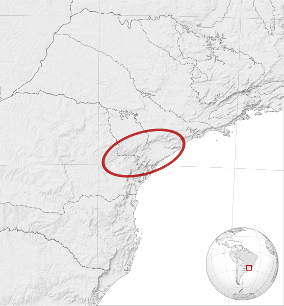
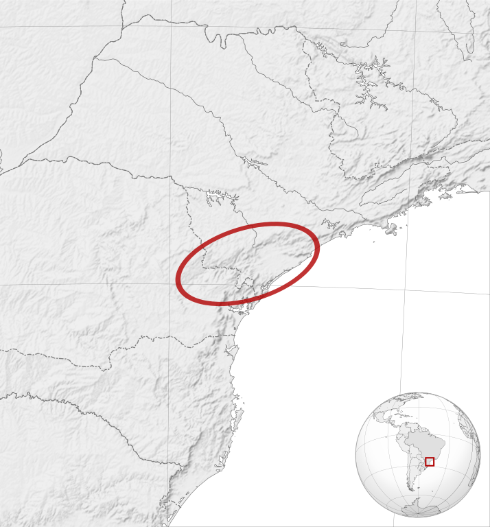
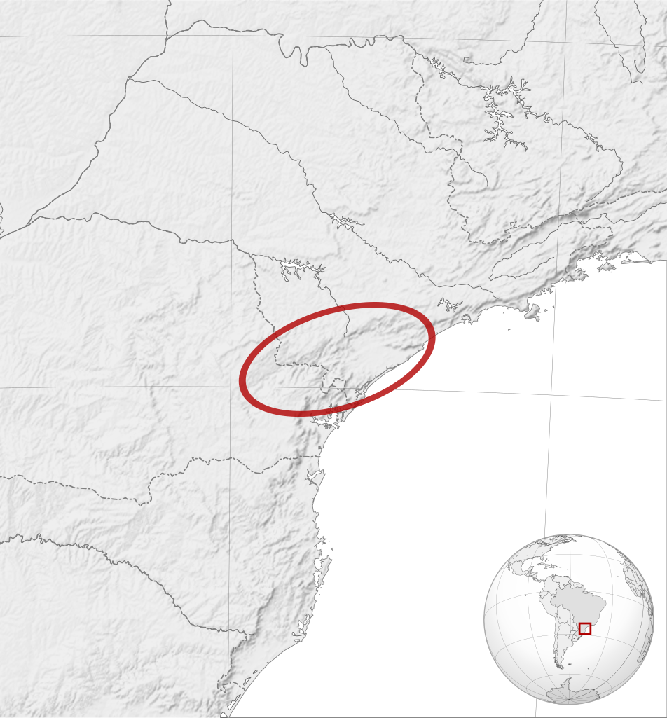
English: Actinote zikani distribution map. Cartographic data :
Français : Aire de répartition du papillon Actinote zikani. Données cartographiques :
|
| Date | |
| Source |
English:
Français : |
| Author | |
| Other versions | |
| Attribution (required by the license) | © Sémhur / Wikimedia Commons / |
| SVG development |
.svg)
| Camera location | | View this and other nearby images on: OpenStreetMap |
|---|
Licensing edit
I, the copyright holder of this work, hereby publish it under the following licenses:
| Copyleft: This work of art is free; you can redistribute it and/or modify it according to terms of the Free Art License. You will find a specimen of this license on the Copyleft Attitude site as well as on other sites. |
This file is licensed under the Creative Commons Attribution-Share Alike 4.0 International, 3.0 Unported, 2.5 Generic, 2.0 Generic and 1.0 Generic license.
- You are free:
- to share – to copy, distribute and transmit the work
- to remix – to adapt the work
- Under the following conditions:
- attribution – You must give appropriate credit, provide a link to the license, and indicate if changes were made. You may do so in any reasonable manner, but not in any way that suggests the licensor endorses you or your use.
- share alike – If you remix, transform, or build upon the material, you must distribute your contributions under the same or compatible license as the original.
You may select the license of your choice.
File history
Click on a date/time to view the file as it appeared at that time.
| Date/Time | Thumbnail | Dimensions | User | Comment | |
|---|---|---|---|---|---|
| current | 19:35, 24 April 2014 | | 1,051 × 1,131 (1.17 MB) | Sémhur (talk | contribs) | Valid SVG |
| 11:59, 8 October 2012 |  | 1,051 × 1,131 (1.28 MB) | Sémhur (talk | contribs) | good size | |
| 11:53, 8 October 2012 |  | 512 × 551 (1.29 MB) | Sémhur (talk | contribs) | == {{int:filedesc}} == {{Information |Description={{Multilingual description |en= en:Actinote zikani distribution map.<br> Cartographic data : * Lambert azimuthal equal-area projection * Limits of the map : N -19.5, W -53.5, S -29.5, E -43.5 |fr=... |
You cannot overwrite this file.
File usage on Commons
The following page uses this file:
File usage on other wikis
The following other wikis use this file:
- Usage on be.wikipedia.org
- Usage on ceb.wikipedia.org
- Usage on fr.wikipedia.org
- Usage on pt.wikipedia.org
- Usage on ru.wikipedia.org
- Usage on sv.wikipedia.org
- Usage on vi.wikipedia.org
- Usage on war.wikipedia.org
- Usage on www.wikidata.org