File:Adelaide trammap 1950s.png
Size of this preview: 493 × 600 pixels. Other resolutions: 197 × 240 pixels | 394 × 480 pixels | 715 × 870 pixels.
Original file (715 × 870 pixels, file size: 138 KB, MIME type: image/png)
Captions
Captions
Add a one-line explanation of what this file represents
Summary edit
| Description |
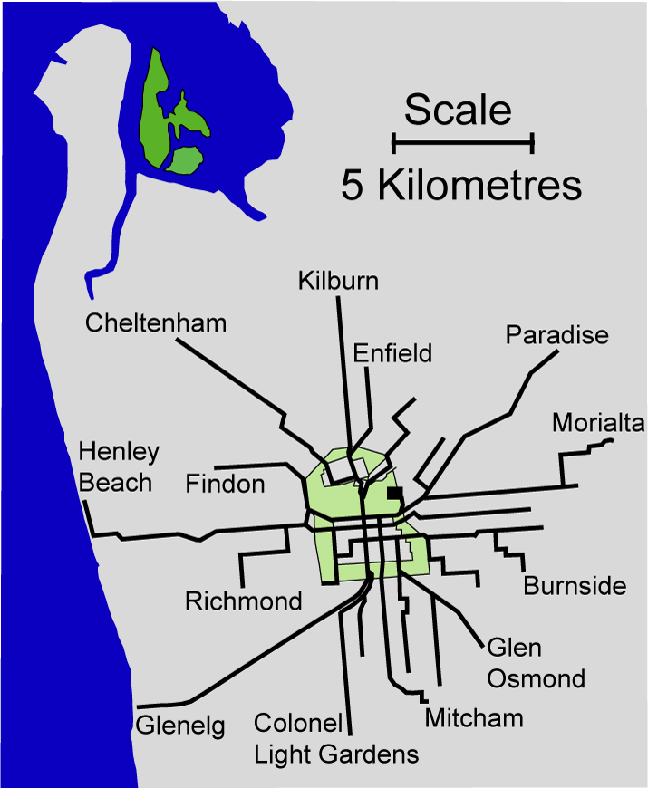
Map of the Adelaide electric tramlines at maximum extent (somewhere between 1952 and 1958). Self created from a 1952 MTT tram map and maps at the St Kilda tram museum Originally uploaded to en:wikipedia then re-uploaded here. Created by Peripitus |
| Date | 18 February 2008 (original upload date) |
| Source | No machine-readable source provided. Own work assumed (based on copyright claims). |
| Author | No machine-readable author provided. Peripitus assumed (based on copyright claims). |
Licensing edit
I, the copyright holder of this work, hereby publish it under the following licenses:

|
Permission is granted to copy, distribute and/or modify this document under the terms of the GNU Free Documentation License, Version 1.2 or any later version published by the Free Software Foundation; with no Invariant Sections, no Front-Cover Texts, and no Back-Cover Texts. A copy of the license is included in the section entitled GNU Free Documentation License. |
| This file is licensed under the Creative Commons Attribution-Share Alike 3.0 Unported license. | ||
| ||
| This licensing tag was added to this file as part of the GFDL licensing update. |
You may select the license of your choice.
File history
Click on a date/time to view the file as it appeared at that time.
| Date/Time | Thumbnail | Dimensions | User | Comment | |
|---|---|---|---|---|---|
| current | 09:22, 18 February 2008 | | 715 × 870 (138 KB) | Peripitus (talk | contribs) | == Summary == Map of the Adelaide electric tramlines at maximum extent (somewhere between 1952 and 1958). Self created from a 1952 MTT tram map and maps at the St Kilda tram museum Originally uploaded to en:wikipedia then re-uploaded here. Created by |
You cannot overwrite this file.
File usage on Commons
The following page uses this file:
File usage on other wikis
The following other wikis use this file:
- Usage on de.wikipedia.org
- Usage on en.wikipedia.org
- Usage on nl.wikipedia.org
- Usage on www.wikidata.org