File:Admiralty Chart No 2615 Portland to Christchurch, Published 1954.jpg

Size of this preview: 800 × 550 pixels. Other resolutions: 320 × 220 pixels | 640 × 440 pixels | 1,024 × 704 pixels | 1,280 × 880 pixels | 2,560 × 1,759 pixels | 16,379 × 11,256 pixels.
Original file (16,379 × 11,256 pixels, file size: 13.62 MB, MIME type: image/jpeg)
Captions
Captions
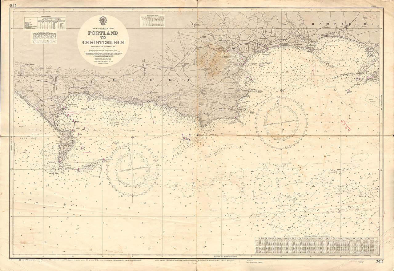
Admiralty Chart No 2615 Portland to Christchurch
Summary edit
| Warning | The original file is very high-resolution. It might not load properly or could cause your browser to freeze when opened at full size. |
|---|
| Description |
English: Nautical chart covering the Portland to Christchurch, and the adjacent coasts to a scale of 1/75,000. Not current - not to be used for navigation! |
||||||||||
| Date | |||||||||||
| Source | Scan of original Admiralty chart | ||||||||||
| Creator |
|
||||||||||
| Geotemporal data | |||||||||||
| Spatial reference system | Mercator | ||||||||||
| Scale | 1:75,000 | ||||||||||
| Bounding box |
|
||||||||||
| Georeferencing | |||||||||||
Mercator projection
Licensing edit
This work created by the United Kingdom Government is in the public domain.
This is because it is one of the following:
HMSO has declared that the expiry of Crown Copyrights applies worldwide (ref: HMSO Email Reply)
|
 |
File history
Click on a date/time to view the file as it appeared at that time.
| Date/Time | Thumbnail | Dimensions | User | Comment | |
|---|---|---|---|---|---|
| current | 17:31, 9 August 2019 | | 16,379 × 11,256 (13.62 MB) | Kognos (talk | contribs) | User created page with UploadWizard |
You cannot overwrite this file.
File usage on Commons
There are no pages that use this file.