File:Admiralty Chart No 998 Ile Makimo to Ile Tahiti, Published 1961.jpg

Size of this preview: 800 × 549 pixels. Other resolutions: 320 × 220 pixels | 640 × 439 pixels | 1,024 × 703 pixels | 1,280 × 879 pixels | 2,560 × 1,758 pixels | 16,387 × 11,252 pixels.
Original file (16,387 × 11,252 pixels, file size: 27.8 MB, MIME type: image/jpeg)
Captions
Captions
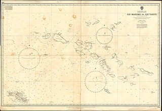
Nautical chart of Ile Makimo to Ile Tahiti
Summary
edit
| Warning | The original file is very high-resolution. It might not load properly or could cause your browser to freeze when opened at full size. |
|---|
Licensing
edit
This work created by the United Kingdom Government is in the public domain.
This is because it is one of the following:
HMSO has declared that the expiry of Crown Copyrights applies worldwide (ref: HMSO Email Reply)
|
 |
File history
Click on a date/time to view the file as it appeared at that time.
| Date/Time | Thumbnail | Dimensions | User | Comment | |
|---|---|---|---|---|---|
| current | 18:29, 19 March 2022 | | 16,387 × 11,252 (27.8 MB) | Kognos (talk | contribs) | Uploaded a work by E.G. Irving from Scan of original Admiralty Chart with UploadWizard |
You cannot overwrite this file.
File usage on Commons
There are no pages that use this file.