File:Adorf Sheet 4618 US-Army 1944 Detail Grube Martenberg.png

Size of this preview: 800 × 511 pixels. Other resolutions: 320 × 204 pixels | 640 × 409 pixels | 1,024 × 654 pixels | 1,203 × 768 pixels.
Original file (1,203 × 768 pixels, file size: 2.1 MB, MIME type: image/png)
Captions
Captions
Add a one-line explanation of what this file represents
Summary
edit
| Camera location | | View this and other nearby images on: OpenStreetMap |
|---|
Licensing
edit
This work is in the public domain in the United States because it is a work prepared by an officer or employee of the United States Government as part of that person’s official duties under the terms of Title 17, Chapter 1, Section 105 of the US Code.
Note: This only applies to original works of the Federal Government and not to the work of any individual U.S. state, territory, commonwealth, county, municipality, or any other subdivision. This template also does not apply to postage stamp designs published by the United States Postal Service since 1978. (See § 313.6(C)(1) of Compendium of U.S. Copyright Office Practices). It also does not apply to certain US coins; see The US Mint Terms of Use.
|
 | |
| This file has been identified as being free of known restrictions under copyright law, including all related and neighboring rights. | ||
File history
Click on a date/time to view the file as it appeared at that time.
| Date/Time | Thumbnail | Dimensions | User | Comment | |
|---|---|---|---|---|---|
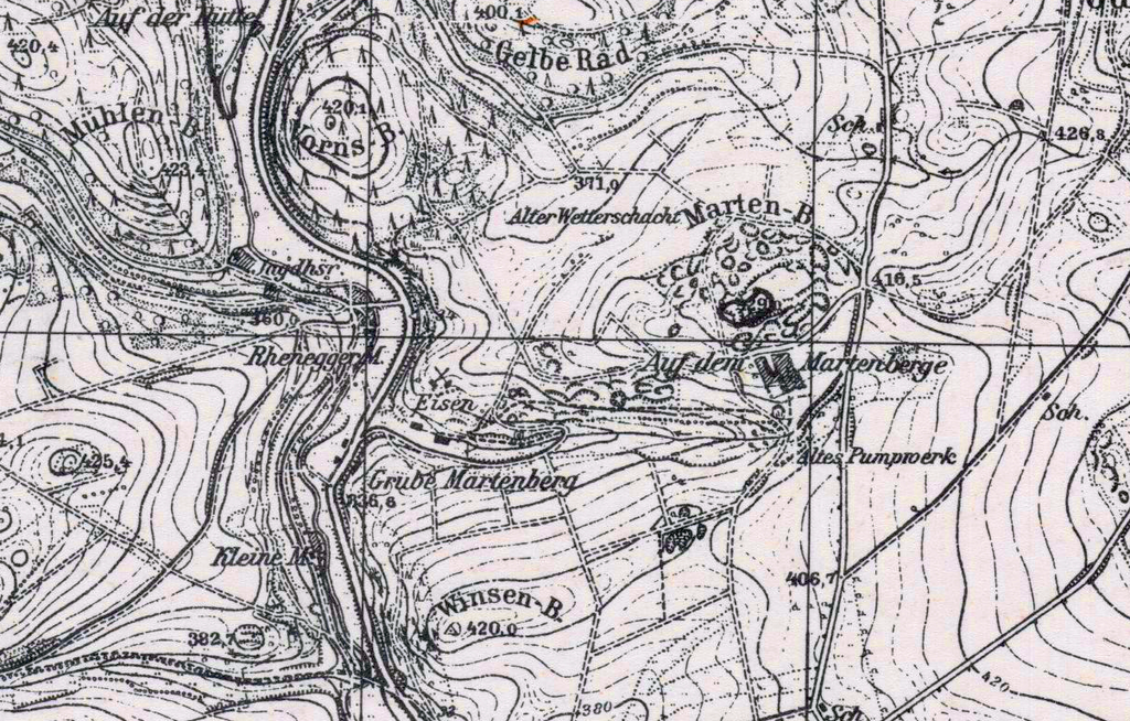
| current | 08:15, 6 December 2020 | | 1,203 × 768 (2.1 MB) | Thombansen (talk | contribs) | =={{int:filedesc}}== {{Map |description={{en|1=Printed Map of Area in Germany; Adorf Sheet 4618; Hessen Waldeck; Detail Area Grube Martenberg}} |date=1944 |source="Prepared by the Army Map Service (LO), Corps of Engineers, U. S. Army, Washington, D.C. Copied in 1944 from Germany , 1:25,000 GSGS, Sheet 4618, 1944, which was copied from an original German map dated 1930. Universal Transverse Mercator Grid added by AMS." |author=U. S. Army Map Service |permission= |other versions= |warp_status=w... |
You cannot overwrite this file.
File usage on Commons
The following page uses this file:
File usage on other wikis
The following other wikis use this file:
- Usage on de.wikipedia.org