File:Aerial image of Moel Arthur - Awyrlun o Foel Arthur; Bryniau Clwyd SSSI; Mehefin 2023 12.jpg

Size of this preview: 800 × 600 pixels. Other resolutions: 320 × 240 pixels | 640 × 480 pixels | 1,024 × 768 pixels | 1,280 × 960 pixels | 2,560 × 1,920 pixels | 4,032 × 3,024 pixels.
Original file (4,032 × 3,024 pixels, file size: 7.44 MB, MIME type: image/jpeg)
Captions
Captions
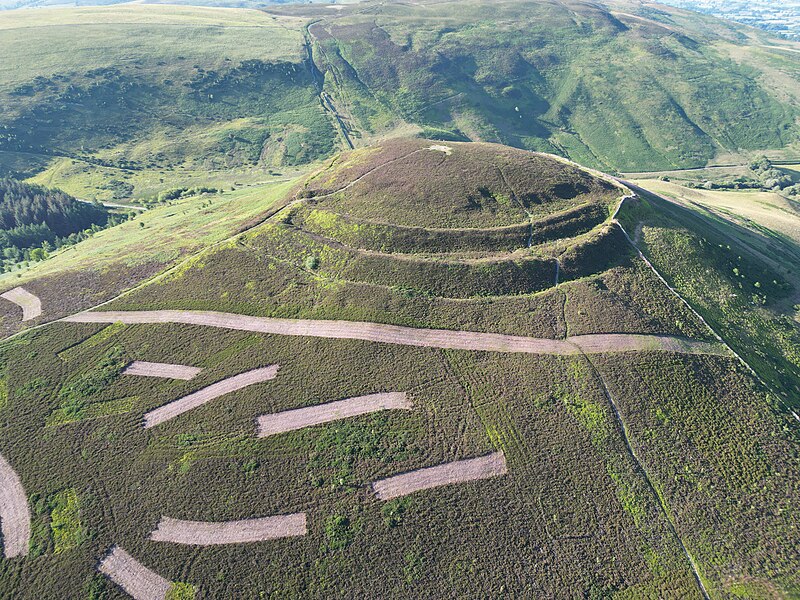
Aerial image of Moel Arthur; Bryniau Clwyd SSSI; June 2023
Summary edit
| Description |
Cymraeg: Awyrlun o Foel Arthur; Bryniau Clwyd SSSI; Mehefin 2023.
Bryn a bryngaer ym Mryniau Clwyd, Sir Ddinbych, yw Moel Arthur (cyfeirnod OS: 145 660). Fe'i lleolir rhwng Llandyrnog (ger Dinbych) i'r gorllewin a Nannerch i'r dwyrain; cyfeiriad grid SJ145660.
English: Aerial image of Moel Arthur; Bryniau Clwyd SSSI; June 2023. |
| Date | |
| Source | Own work |
| Author | Llywelyn2000 |
| Camera location | | View this and other nearby images on: OpenStreetMap |
|---|
Licensing edit
I, the copyright holder of this work, hereby publish it under the following license:
This file is licensed under the Creative Commons Attribution-Share Alike 4.0 International license.
- You are free:
- to share – to copy, distribute and transmit the work
- to remix – to adapt the work
- Under the following conditions:
- attribution – You must give appropriate credit, provide a link to the license, and indicate if changes were made. You may do so in any reasonable manner, but not in any way that suggests the licensor endorses you or your use.
- share alike – If you remix, transform, or build upon the material, you must distribute your contributions under the same or compatible license as the original.
This image was uploaded as part of Wiki Loves Earth 2023.
|
 |
File history
Click on a date/time to view the file as it appeared at that time.
| Date/Time | Thumbnail | Dimensions | User | Comment | |
|---|---|---|---|---|---|
| current | 05:53, 19 June 2023 | | 4,032 × 3,024 (7.44 MB) | Llywelyn2000 (talk | contribs) | Uploaded own work with UploadWizard |
You cannot overwrite this file.
File usage on Commons
The following page uses this file: