File:Aerial of Kettle River mouth, the sloughs, Atslukstin, and Marcus. c. 1938. (3cbe0330-d80c-4d18-a448-c6daffcfd35a).jpg

Size of this preview: 800 × 587 pixels. Other resolutions: 320 × 235 pixels | 640 × 470 pixels | 1,024 × 752 pixels | 1,280 × 940 pixels | 2,560 × 1,880 pixels | 5,732 × 4,209 pixels.
Original file (5,732 × 4,209 pixels, file size: 2.4 MB, MIME type: image/jpeg)
Captions
Captions
Add a one-line explanation of what this file represents

|
The categories of this image need checking. You can do so here.
|
.jpg&action=edit&withJS=MediaWiki:Catcheck.js)
Summary edit
.jpg&action=edit§ion=1)
| English: LARO 3222 | ||||
|---|---|---|---|---|
| Photographer |
English: NPS photo |
|||
| Title |
English: LARO 3222 |
|||
| Description |
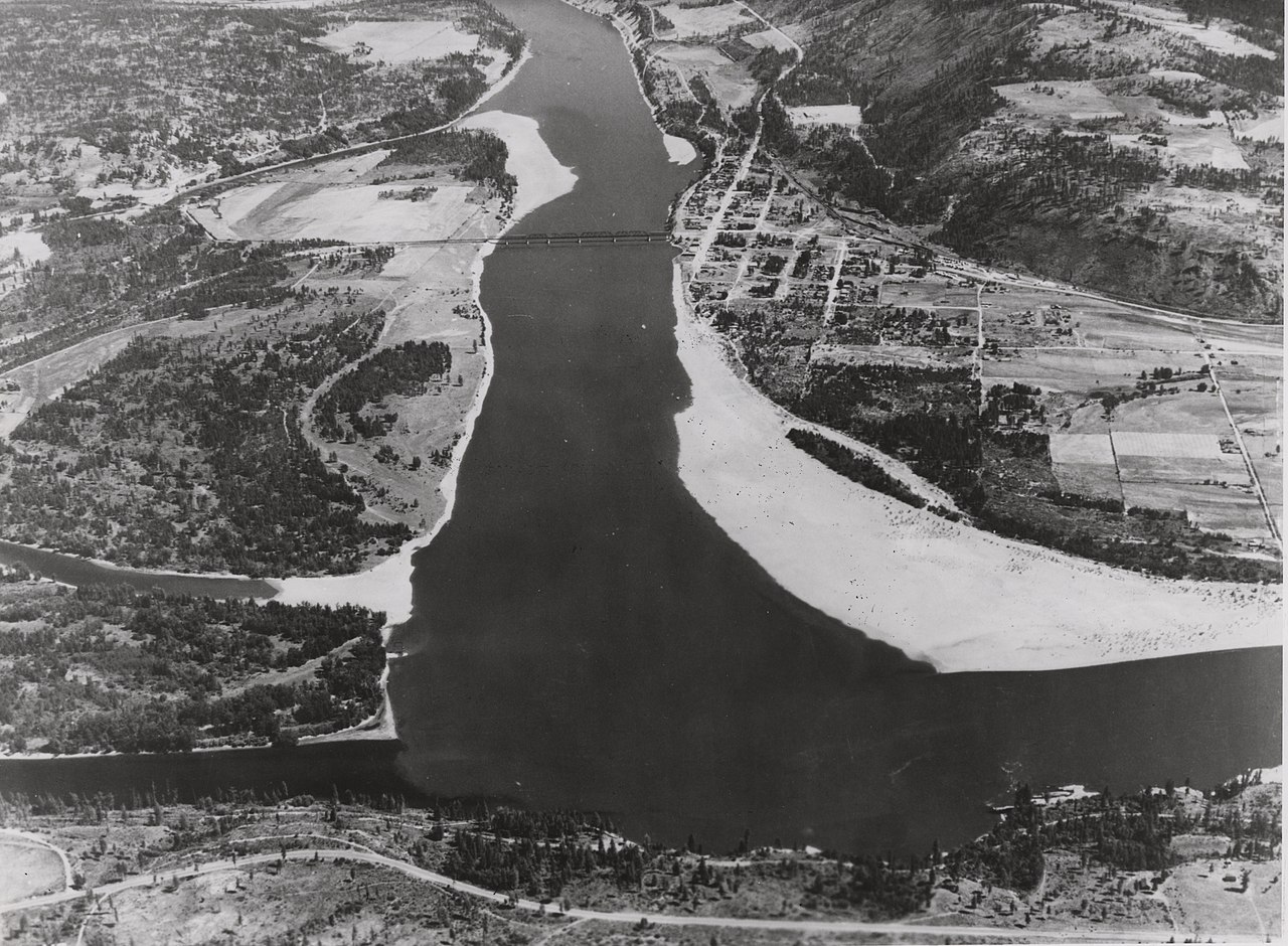
English: Black and white aerial photograph of a river with a bridge spanning it and a town on one side Aerial of Kettle River mouth, the sloughs, Atslukstin, and Marcus. c. 1938.
|
|||
| Depicted place |
English: Lake Roosevelt National Recreation Area, Washington |
|||
| Date | Taken on 24 October 2005 | |||
| Accession number | ||||
| Source |
English: NPGallery |
|||
| Permission (Reusing this file) |
|
|||
| NPS Unit Code | LARO | |||
| Album(s) | English: Kettle Falls; Surveys and Surveyors |
|||
File history
Click on a date/time to view the file as it appeared at that time.
| Date/Time | Thumbnail | Dimensions | User | Comment | |
|---|---|---|---|---|---|
| current | 01:04, 7 June 2022 | | 5,732 × 4,209 (2.4 MB) | BMacZeroBot (talk | contribs) | Batch upload (Commons:Batch uploading/NPGallery) |
You cannot overwrite this file.
File usage on Commons
The following page uses this file:
.jpg)
.jpg&oldid=782615286)