File:Ago Bay Map.jpg
No higher resolution available.
Ago_Bay_Map.jpg (795 × 598 pixels, file size: 66 KB, MIME type: image/jpeg)
Captions
Captions
Add a one-line explanation of what this file represents
Summary edit
| Description |
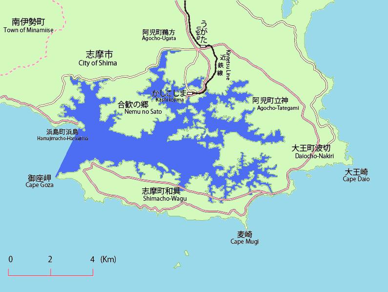
English: This is the map of Ago Bay in Shima,Mie,Japan.
Bule is Ago Bay, Aqua is Philippine Sea, Pink is Japan Route, Yellow is Mie prefectural road.
日本語: 日本国三重県志摩市の英虞湾の地図。
青が英虞湾、水色が太平洋、桃色が国道、黄色が三重県道である。 |
| Date | |
| Source | Own work |
| Author | Miyuki Meinaka |
| Other versions | File:Ago Bay Map.GIF |
Licensing edit
| I, the copyright holder of this work, release this work into the public domain. This applies worldwide. In some countries this may not be legally possible; if so: I grant anyone the right to use this work for any purpose, without any conditions, unless such conditions are required by law. |
File history
Click on a date/time to view the file as it appeared at that time.
| Date/Time | Thumbnail | Dimensions | User | Comment | |
|---|---|---|---|---|---|
| current | 04:49, 3 November 2010 | | 795 × 598 (66 KB) | Miyuki Meinaka (talk | contribs) | Minor Edit. |
| 04:48, 3 November 2010 |  | 795 × 598 (66 KB) | Miyuki Meinaka (talk | contribs) | {{Information |Description={{en|1=This is the map of Ago Bay in Shima,Mie,Japan. Bule is Ago Bay, Aqua is Philippine Sea, Pink is Japan Route, Yellow is Mie prefectural road.}} {{ja|1=日本国三重県志摩市の英虞湾の地図。 青が英虞湾、� |
You cannot overwrite this file.
File usage on Commons
The following page uses this file:
File usage on other wikis
The following other wikis use this file: