File:AirMeranerHoehenweg (3D Südtirol) 51.jpg

Size of this preview: 800 × 400 pixels. Other resolutions: 320 × 160 pixels | 640 × 320 pixels | 1,024 × 512 pixels | 1,280 × 640 pixels | 2,560 × 1,280 pixels | 11,744 × 5,872 pixels.
Original file (11,744 × 5,872 pixels, file size: 15.44 MB, MIME type: image/jpeg)
Captions
Captions
Add a one-line explanation of what this file represents
Summary edit
_51.jpg&action=edit§ion=1)
| Description |
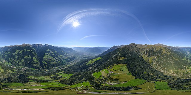
English: 360° aerial panoramic view of South Tyrol
Italiano: Immagine panoramica aerea a 360° dell'Alto Adige
Deutsch: 360° Luftpanoramablick von Südtirol |
| Date | |
| Source | Südtirol 3D |
| Author |
| Camera location | | View this and other nearby images on: OpenStreetMap |
|---|
_51.jpg¶ms=046.727036_N_0011.178932_E_globe:Earth_type:camera_alt:1593_source:exif_heading:293.50&language=en)
| This 360° panorama of South Tyrol was donated by Stiftung Südtiroler Sparkasse.
The image was created by Spherea3D and spread by IDM Südtirol-Alto Adige. |
 |
| 360° | View in 360° panoramic viewer
|
|---|
_51.jpg)
Licensing edit
_51.jpg&action=edit§ion=2)
| This file is made available under the Creative Commons CC0 1.0 Universal Public Domain Dedication. | |
| The person who associated a work with this deed has dedicated the work to the public domain by waiving all of their rights to the work worldwide under copyright law, including all related and neighboring rights, to the extent allowed by law. You can copy, modify, distribute and perform the work, even for commercial purposes, all without asking permission.
|
File history
Click on a date/time to view the file as it appeared at that time.
| Date/Time | Thumbnail | Dimensions | User | Comment | |
|---|---|---|---|---|---|
| current | 22:56, 4 October 2018 | | 11,744 × 5,872 (15.44 MB) | CristianNX (talk | contribs) | Uploaded with ComeOn! 3.5.1 |
You cannot overwrite this file.
File usage on Commons
The following page uses this file:
_51.jpg&oldid=786732620)